Hole No.
3ST-16
l
OIV'SION
.
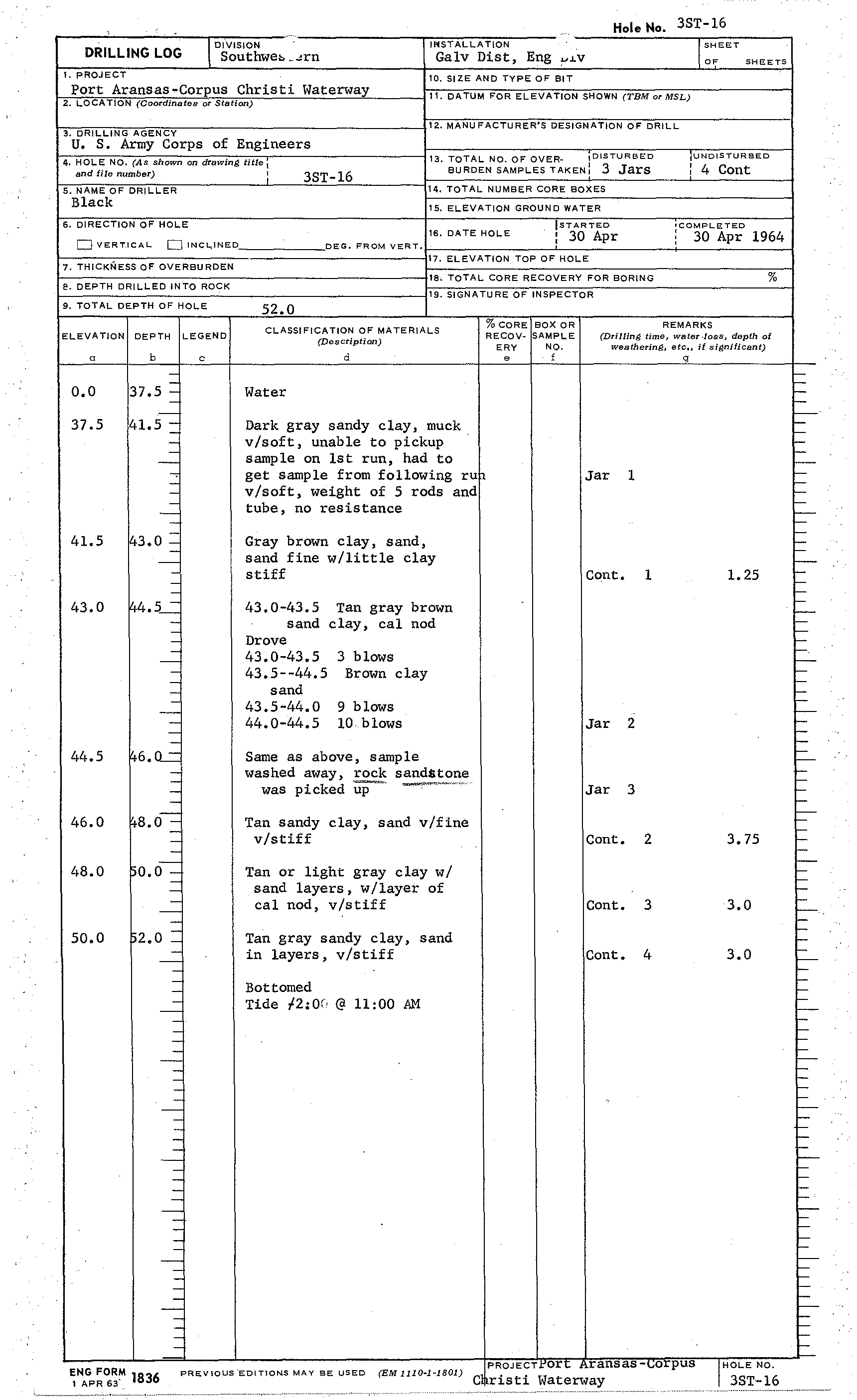
DRILLING LOG
_ Southwe»
_~rn
I
SHEET
OF
SHEETS
IIliSTALLATlON
Galv Dist, Eng
~LV
1.
pROJECT
10. SIZE AND TYPE OF BIT
Port Aransas-Corpus Christi Waterway
11. DATUM FOR ELEVATION SHOWN
(TBMorMSL)
2. LOCATioN
(Coordinates- or-Station)
3. DRILLING AGENCY
12. MANUFACTURER'S DESIGNATION OF' DRILL
U. S. Army Corps of Engineers
4. HOLE NO.
(As shown
on
drawing title
I
and
file
number)
3ST-16
13. TOTAL NO. OF OVER-
,DISTURBED
BURDEN SAMPLES TAKEN:
3 Jars
lUND1STURBED
: 4 Cont
5. NAME OF DRILLER
Black
6. DIRECTION OF HOLE
D
VERT.leAL DINcl,lNED
7. THICKNESS OF OVERBURDEN
e.
DEPTH DRILLED INTO ROCK
9. ToTAL DEPTH OF HOLE
ELEVATION
I
DEPTH ILEGEND
a
0.0
37.5
41.5
43.0
44.5
46.0
48.0
50.0
b
37.5 -
41.5 -
~
-,
[43.0 =
~4.5--=
6.u..=
8.0 -
~O.O
_
15
2•0
=
-
c
14. TOTAL NUMBER CORE BOXES
15. ELEVATION GROUND WATER
ISTARTED
: 30 Apr
'COMPLETED
, 30 Apr 1964
DEG. FROM VERT.
16. DATE HOl E
17. ELEVATION ToP OF HOLE
18. TOTAL CORE RECOVERY FOR BORlNG
%
19. SIGNATURE OF INSPECTOR
52.0
REMARKS
CLASSIFICATION OF MATERIALS
(Description)
d
%COREIBOX OR
RECOV- SAMPLE
ERY
NO.
e
f
(Drilling time, water.loss, depth
of
weathering, etc"
if
significant)
g
Water
Dark gray sandy clay, muck
v/soft, unable to pickup
sample on 1st run, had to
get sample from following ru
v/soft, weight of 5 rods and
tube, no resistance
Gray brown clay, sand,
sand fine w/little clay
stiff
43.0-43.5
Tan gray brown
sand clay, cal nod
Drove
43.0-43.5
3 blows
43.5--44.5 Brown clay
sand
43.5-44.0 9 blows
44.0-44.5 10 blows
Same as above, sample
washed away,
rock sandstone
was picked
~<
.....",-"-""
Tan sandy clay, sand v/fine
v/stiff
Tan or Ught gray clay w/
sand layers, w/layer of
cal nod, v/stiff
Tan gray sandy clay, sand
in layers, v/stiff
Bottomed
Tide
f2:Qf,
@ 11:00 AM
Jar 1
Cont. 1
1.25
Jar 2
Jar 3
Cont. 2