
GEOTECHNICAL CORE DRILLING, SOIL SAMPLING, AND LABORATORY TESTING
USACE, Galveston District W912HY‐13‐D‐0001
Government & Industry in Harmony with the Environment
1.0
Introduction
Task Order DY08, Core Drilling, Soil Sampling, and Laboratory Testing for the Port Arthur
Resident Office Shoreline Stabilization project, Port Arthur, Texas, was awarded to Quaternary
Resource Investigations, LLC (QRI) on November 19, 2013 (Notice to Proceed (NTP) received on
November 29, 2013). The primary purpose of this Task Order was to obtain geotechnical
information for shoreline stabilization at the Port Arthur Resident Office, Jefferson County,
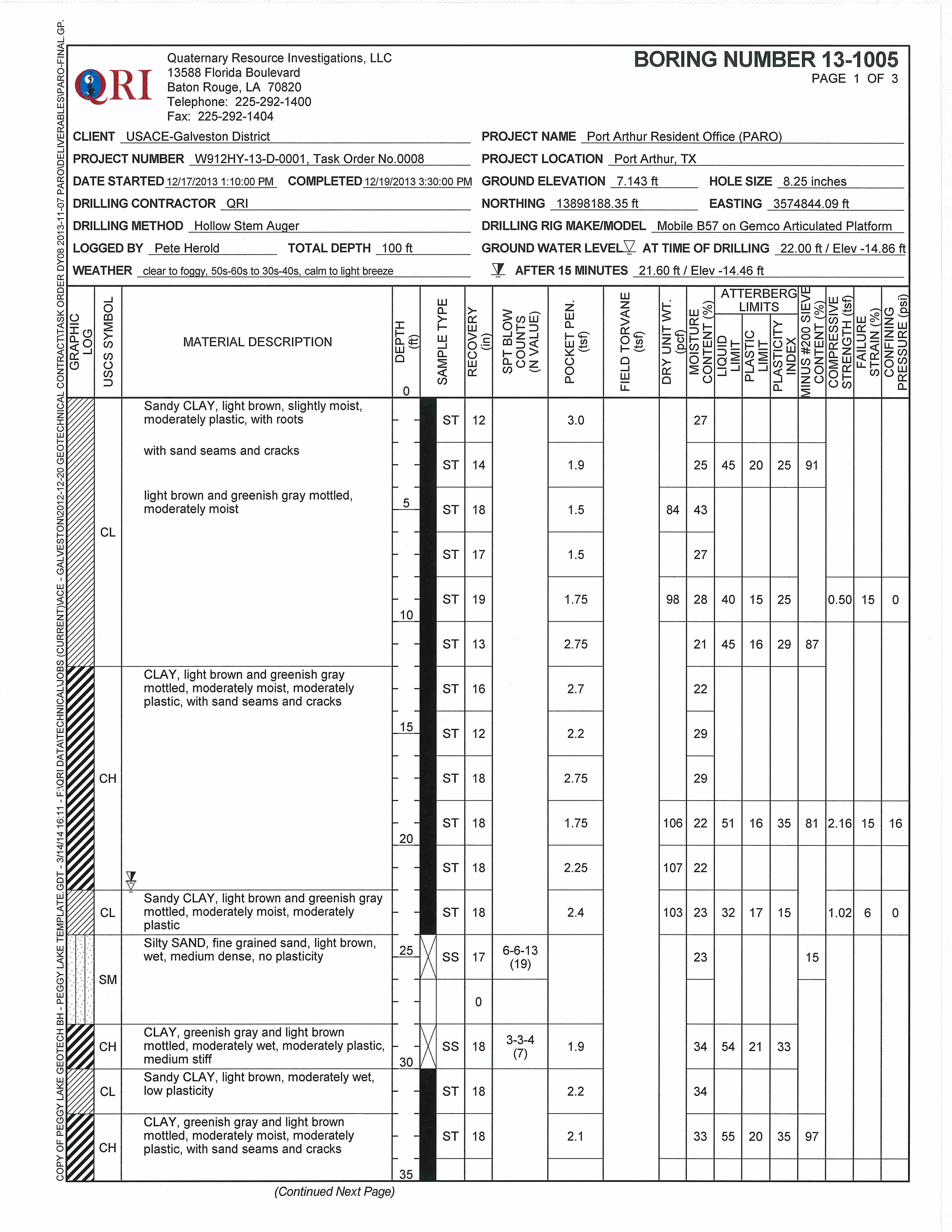
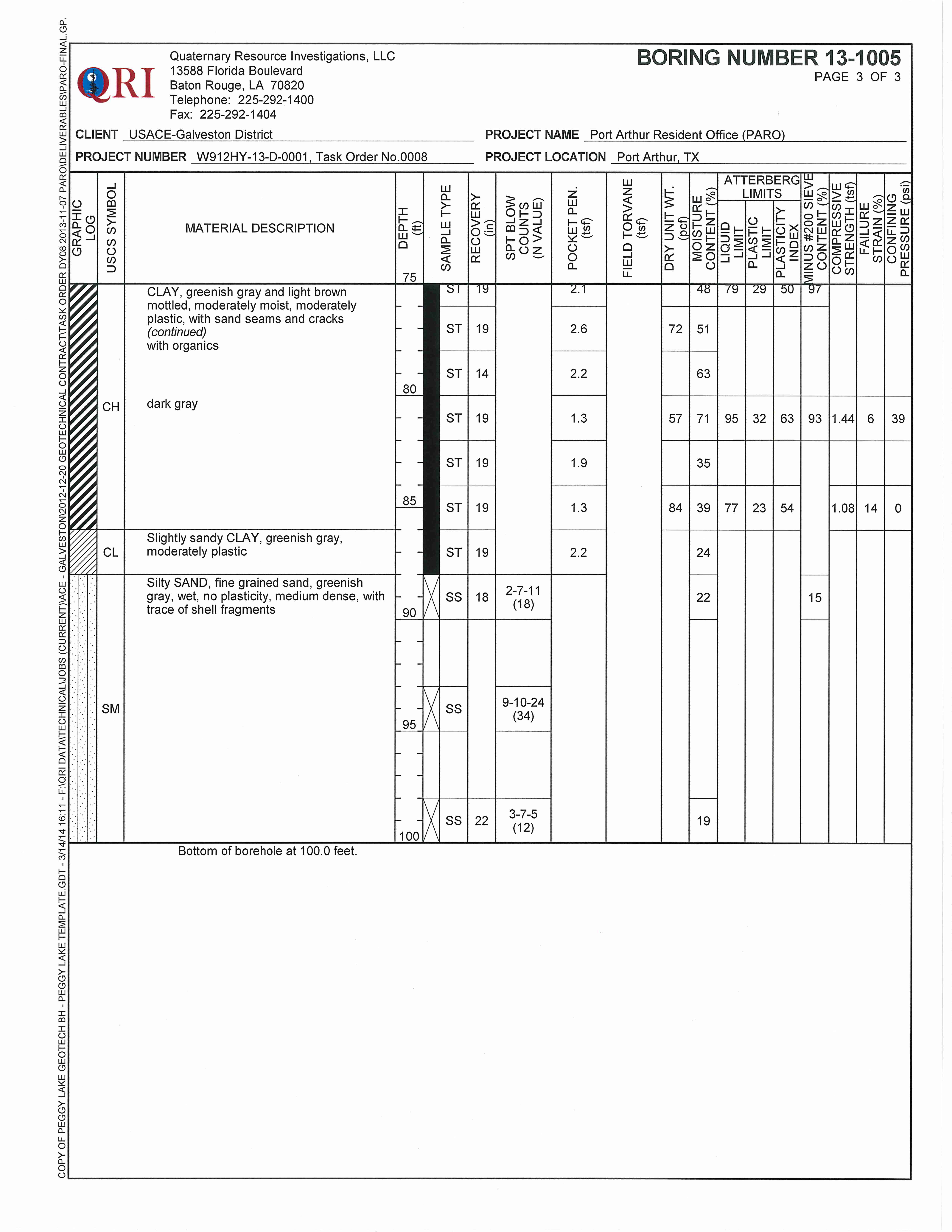
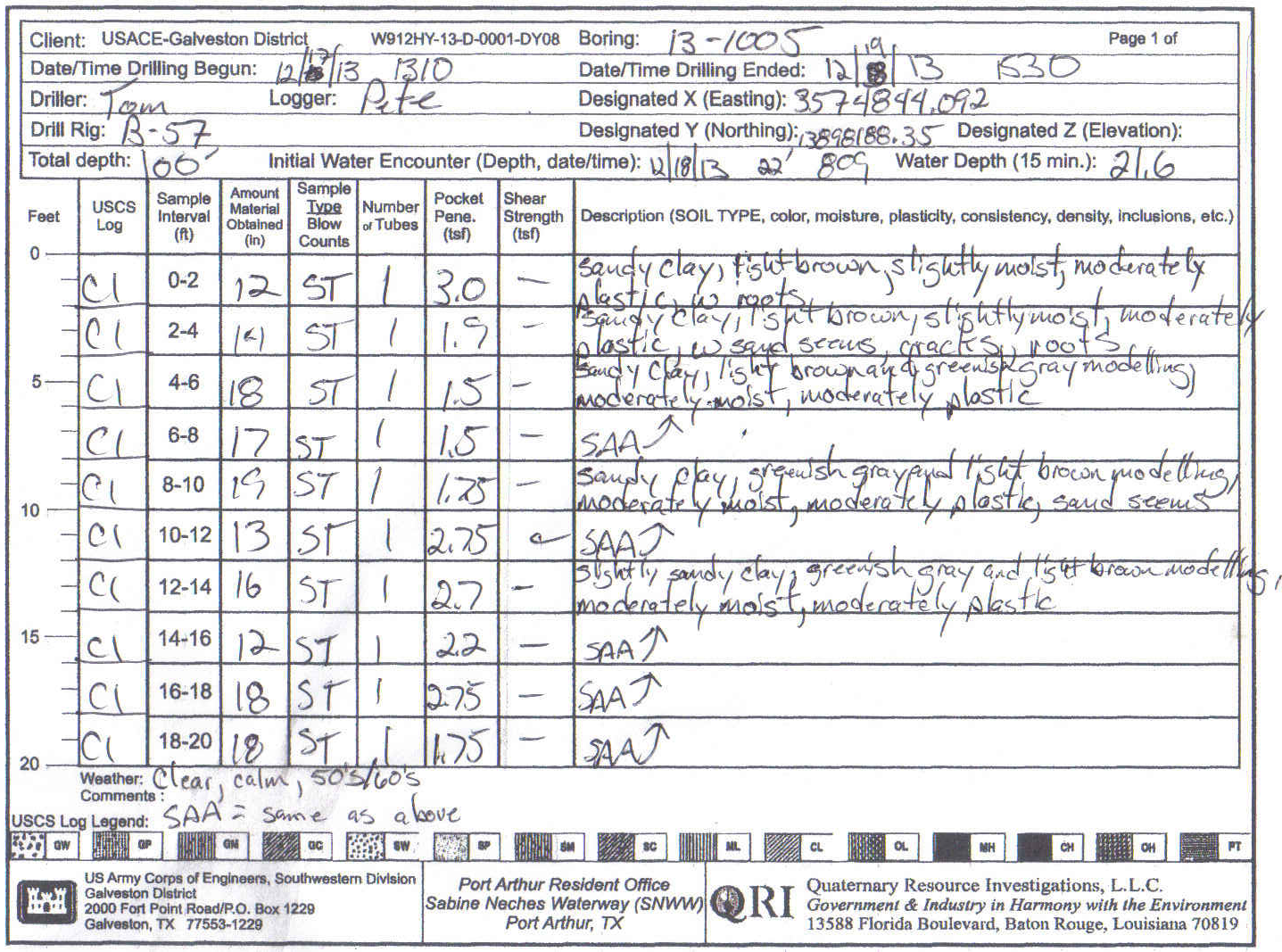
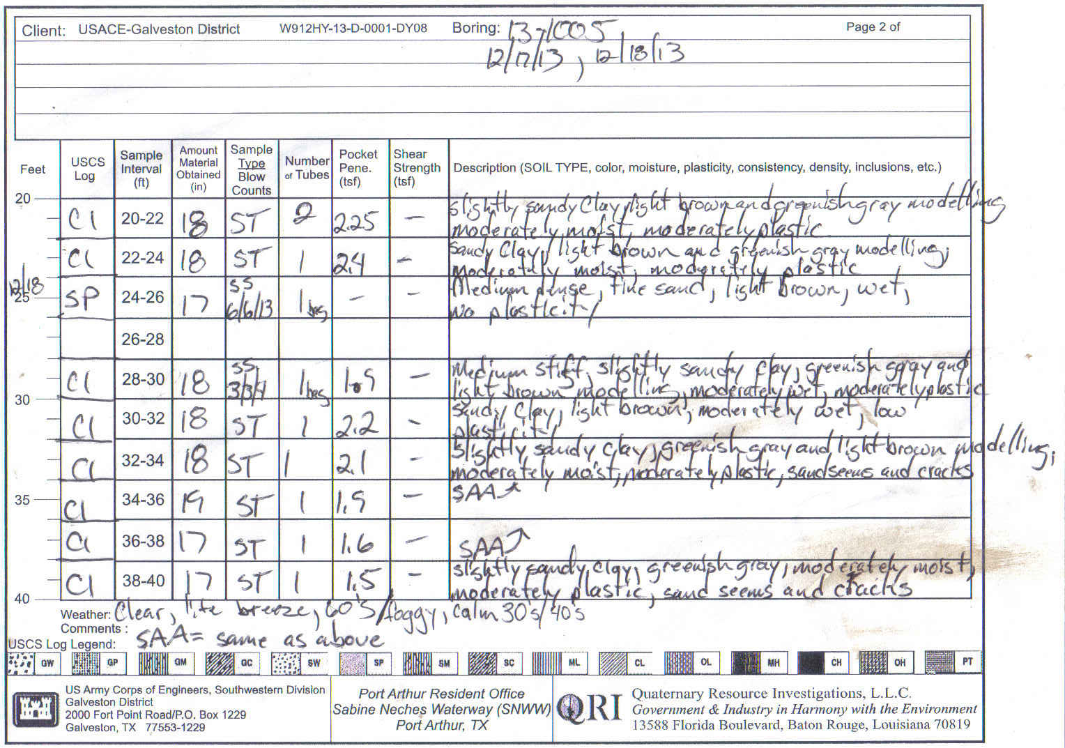
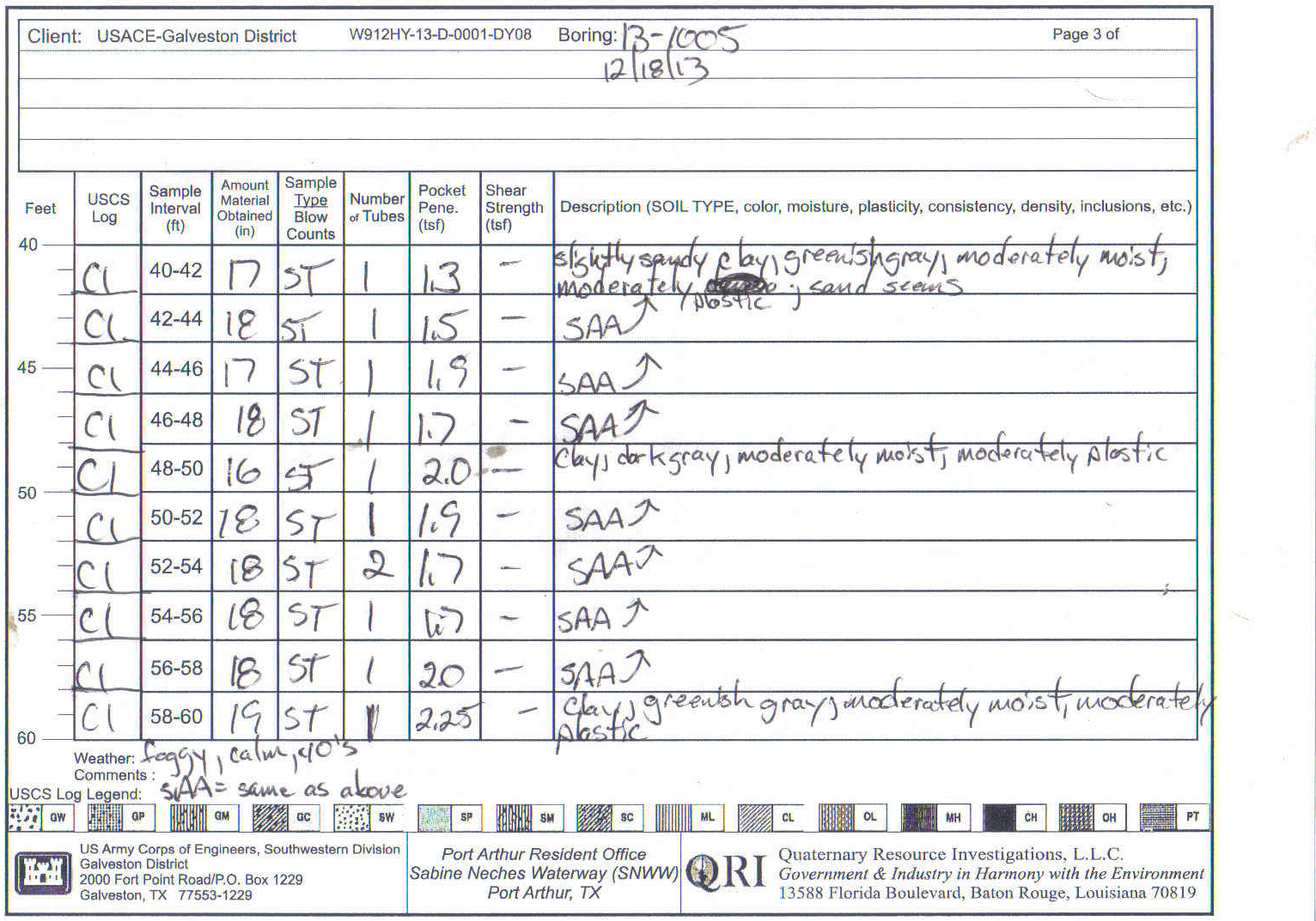
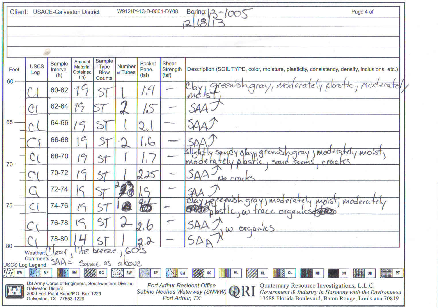
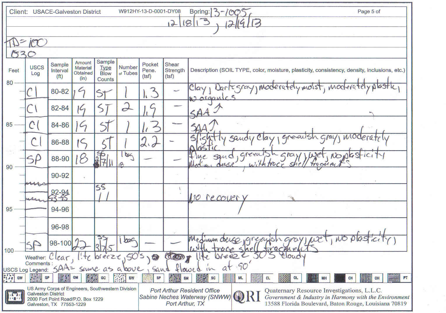
Texas. A total of 5 borings, numbered 13‐1001 through 13‐1005, were drilled to depths of 80
and 100 feet as shown on
Table 1
below.
2.0
Borings
Below is a table summarizing the 5 borings drilled under Task Order DY08. The table includes
Boring Number, Investigation Feature, Depth (ft), and a description of unusual subsurface
conditions or difficulties in drilling that were encountered (if any). Boring Summary Sheets and
Field boring logs (
Appendix A
) should be referenced for information concerning each boring.
Table 1
Boring
Investigation Feature
Depth (ft)
Conditions / Difficulties Encountered
13‐1001
East Bank SNWW PARO
100
See boring log
13‐1002
East Bank SNWW PARO
80
See boring log
13‐1003
East Bank SNWW PARO
100
See boring log
13‐1004
East Bank SNWW PARO
80
See boring log
13‐1005
East Bank SNWW PARO
100
See boring log
Final gINT Boring Logs are included in
(
Appendix B
).
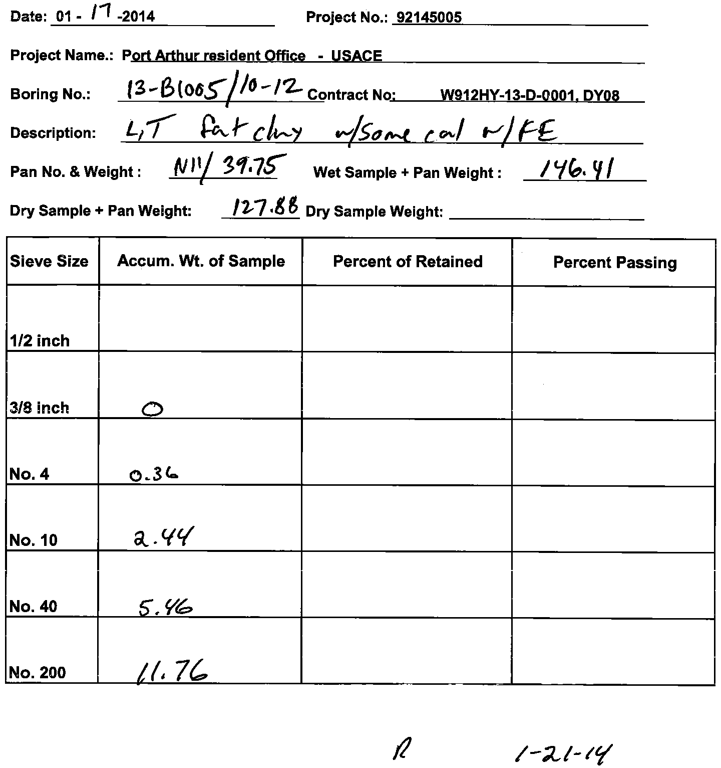
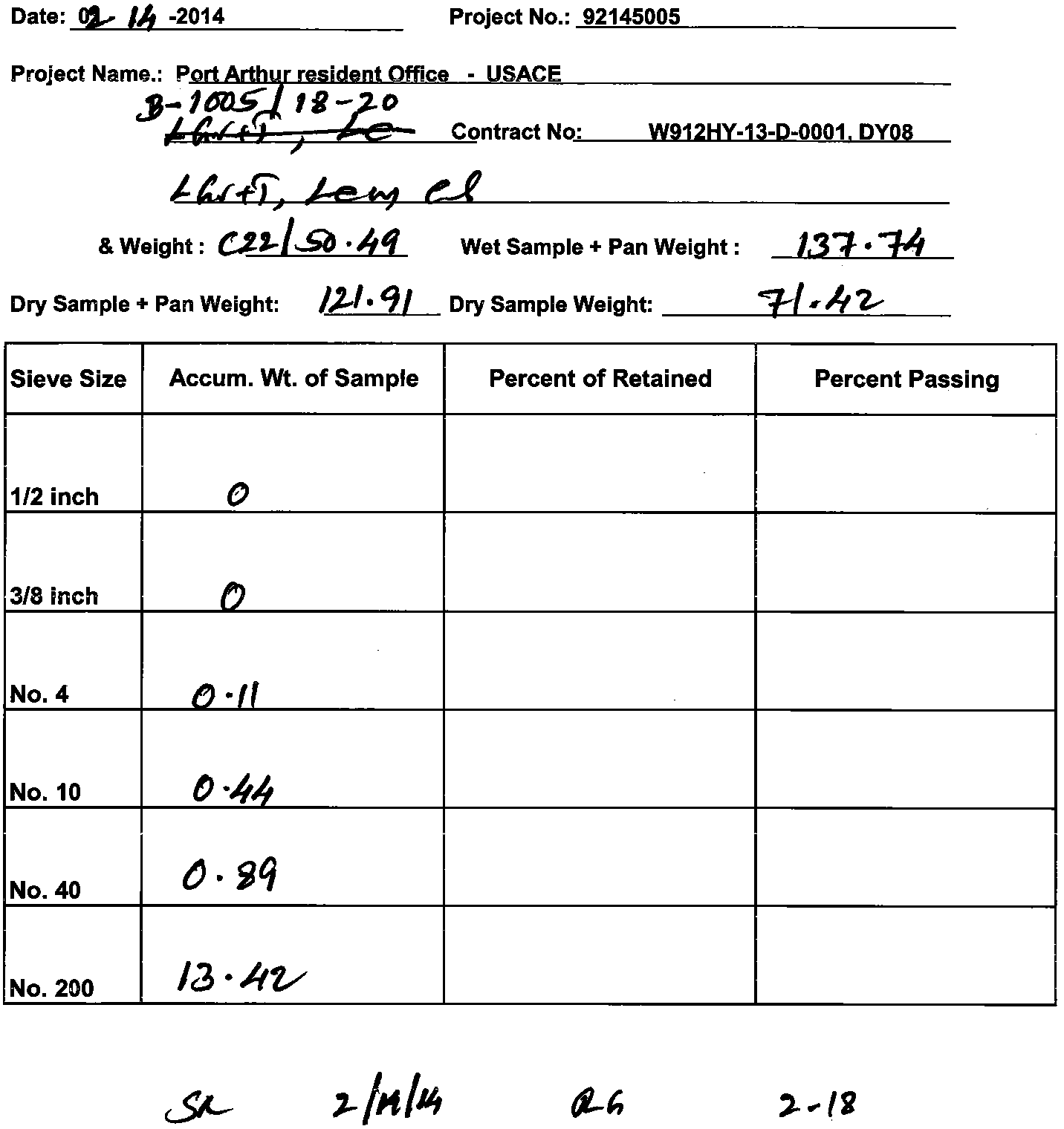
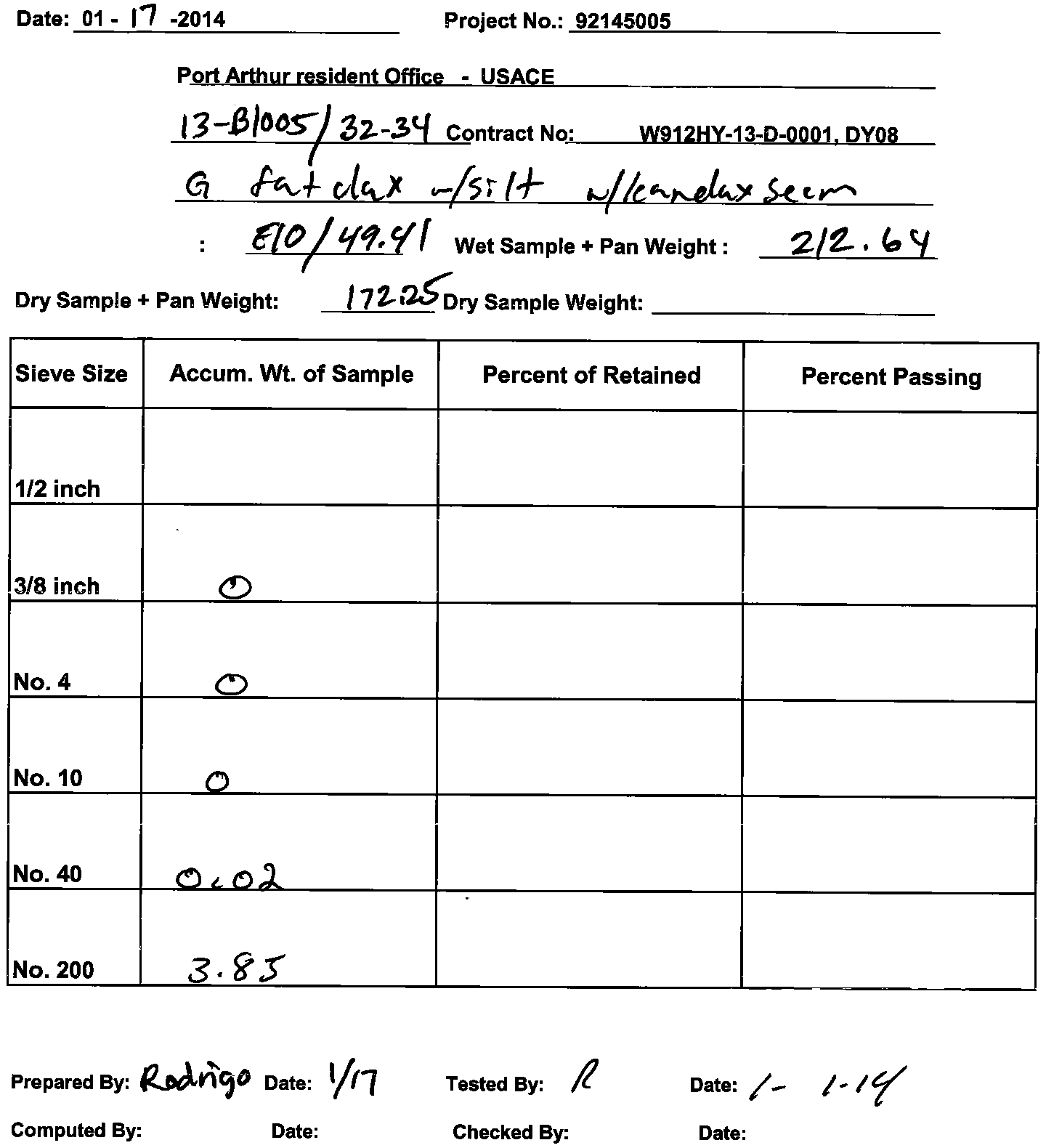
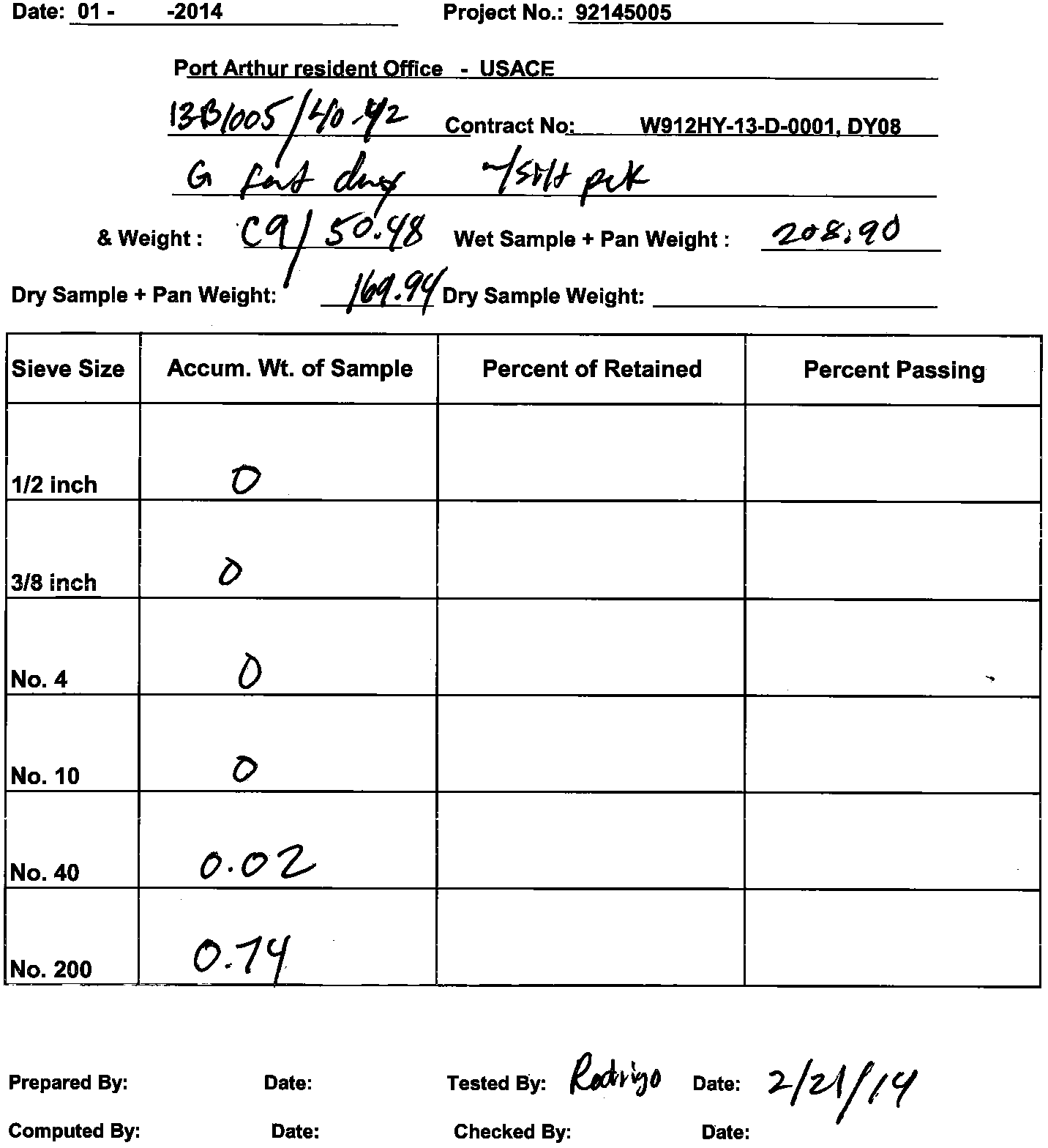
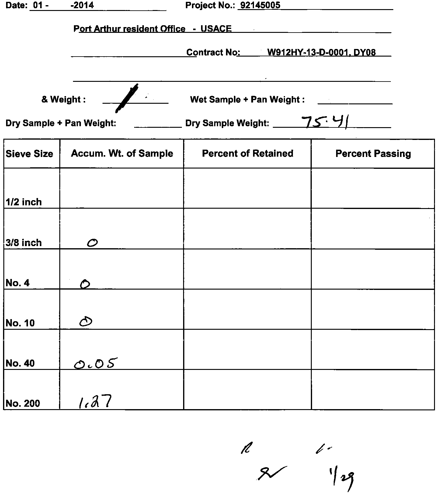
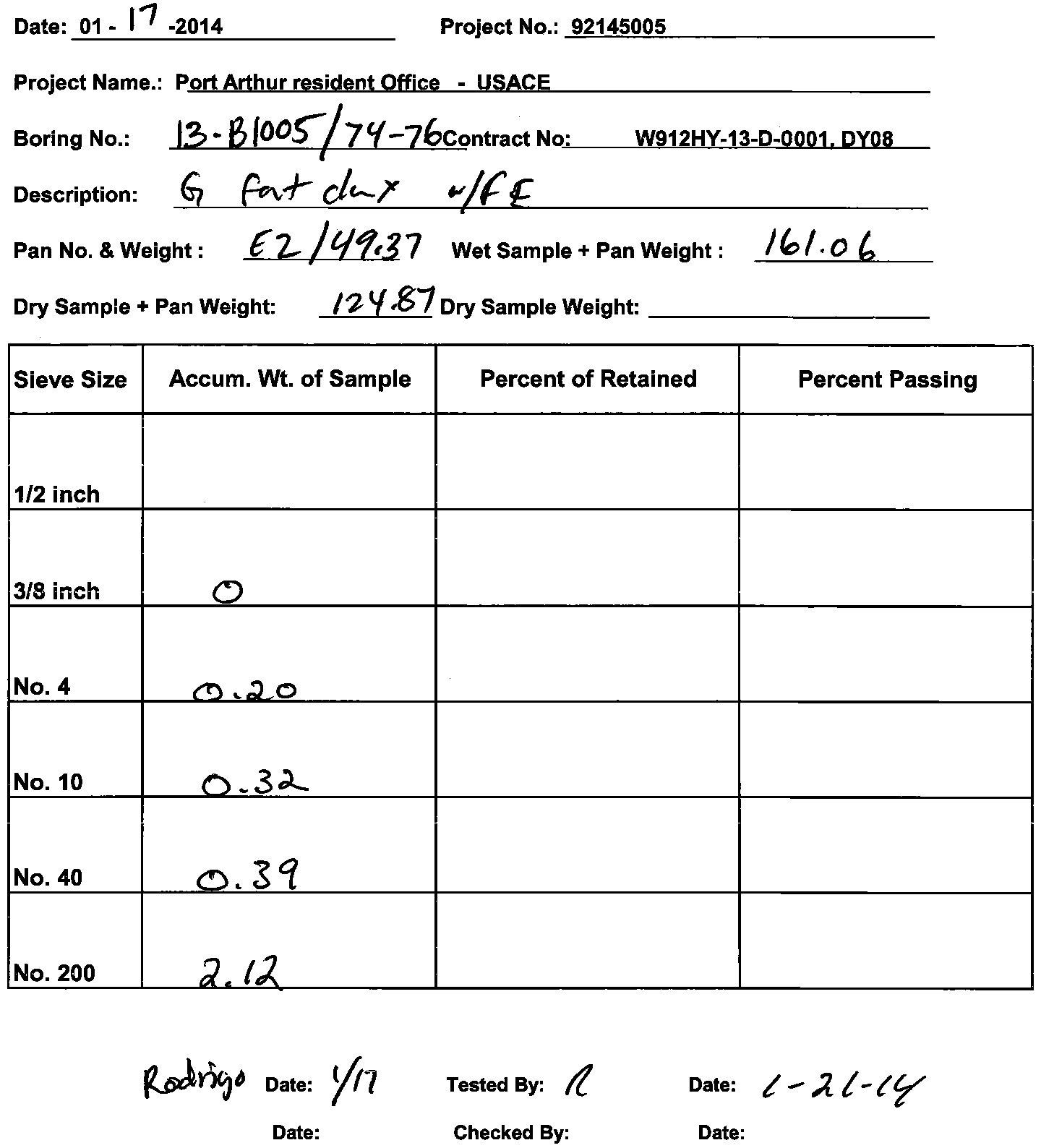
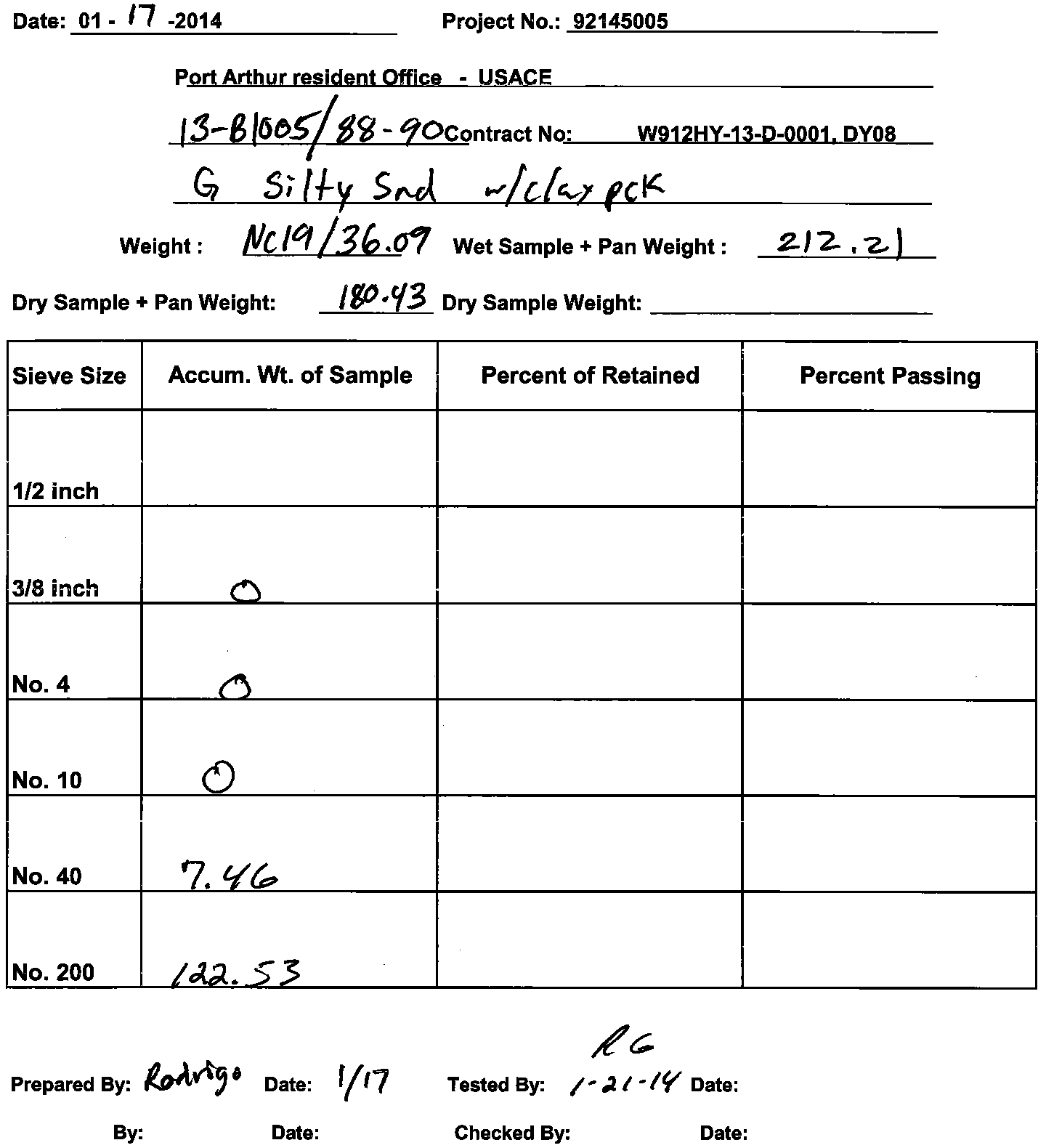
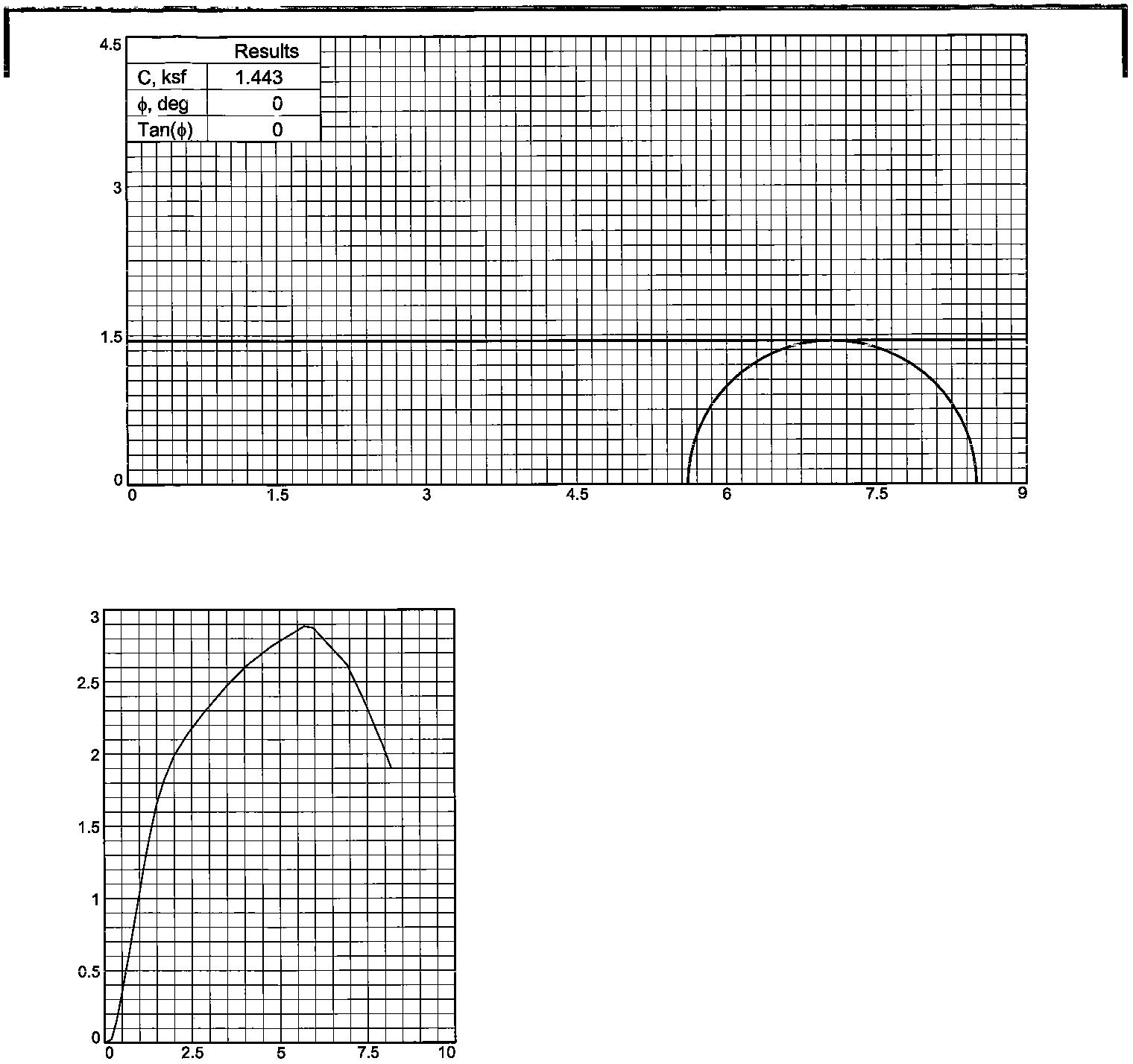
3.0
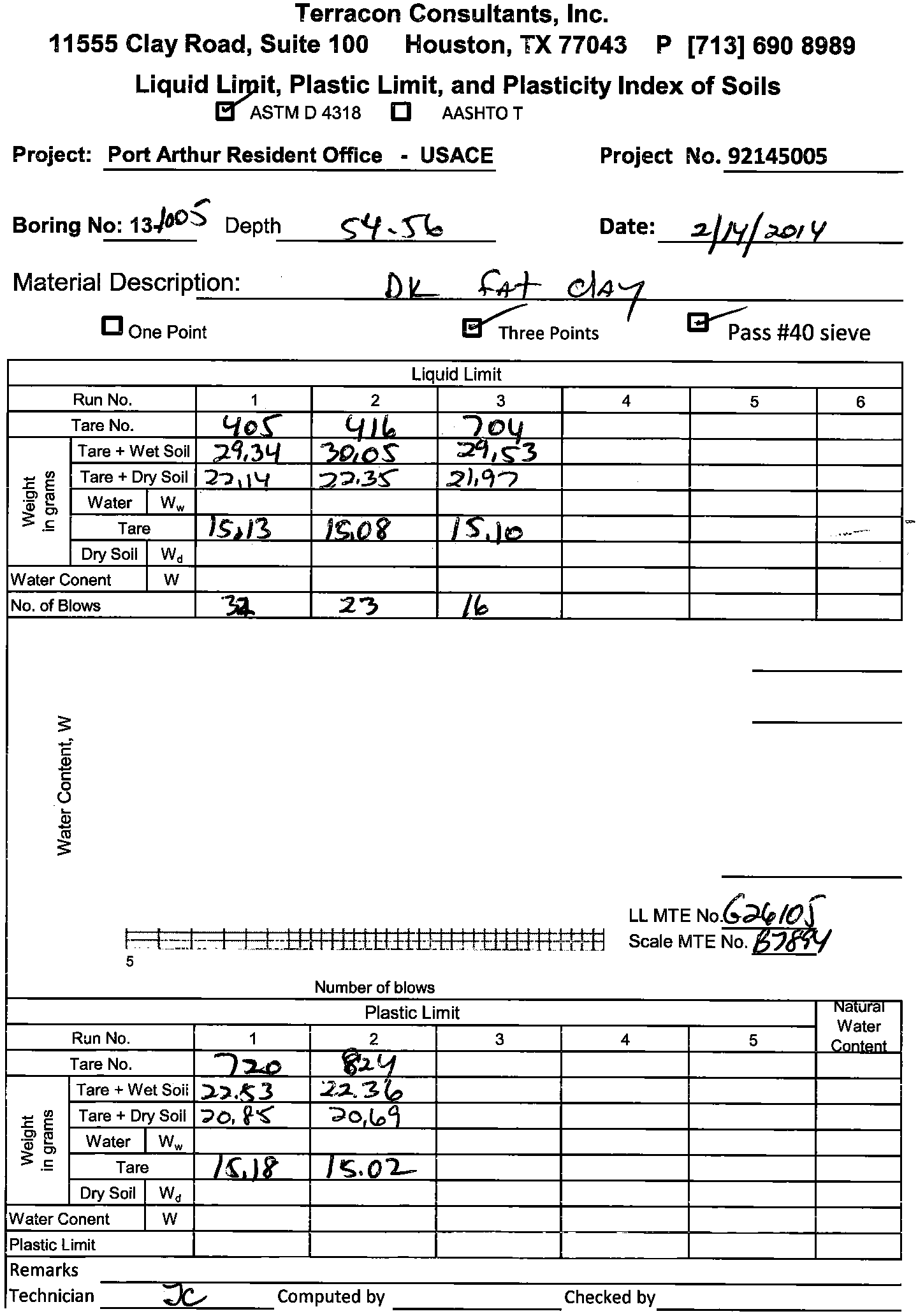
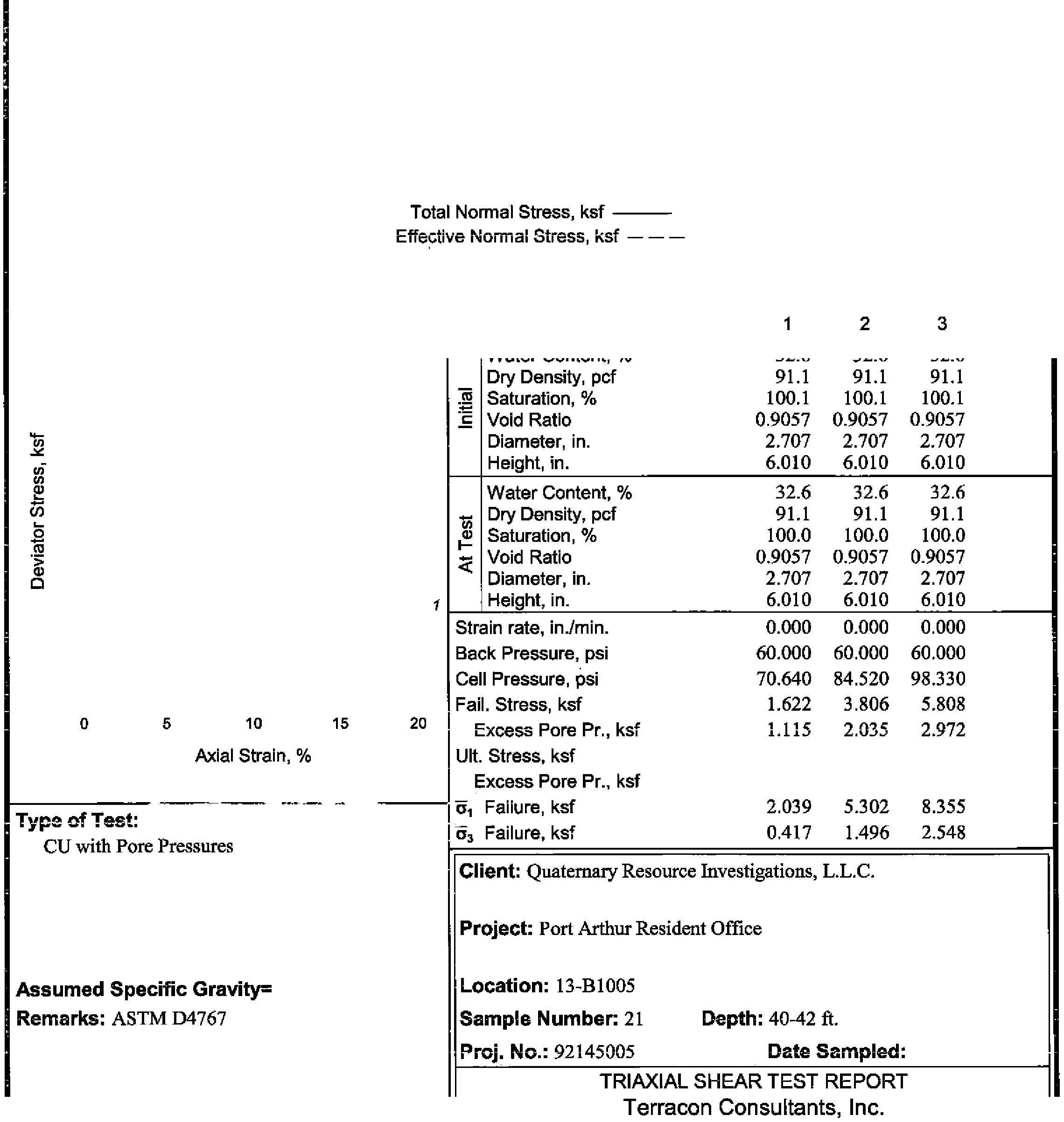
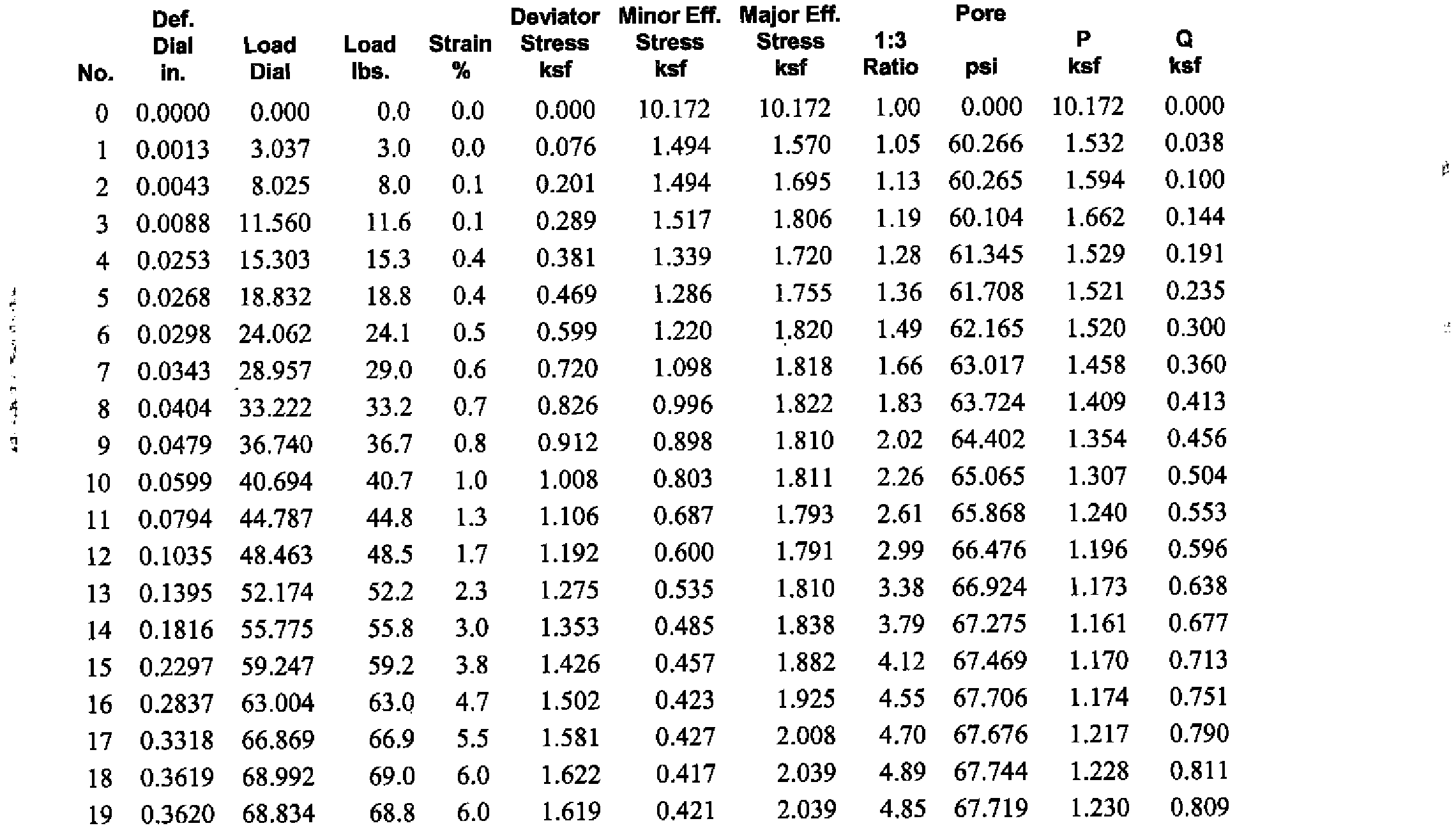
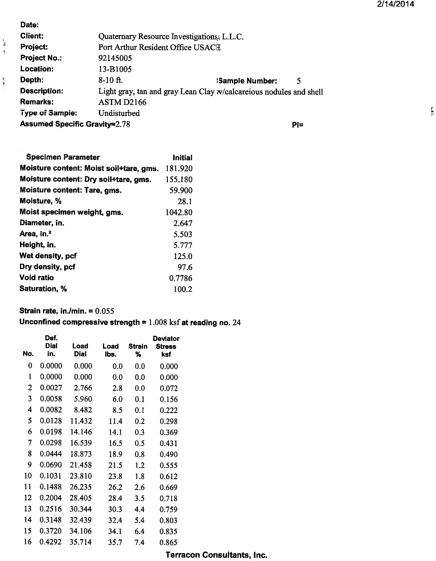
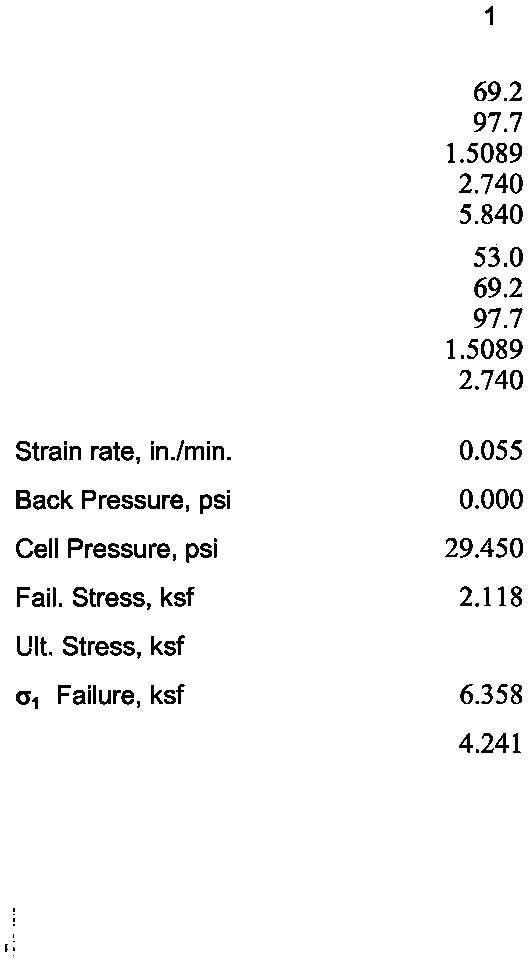
Test data
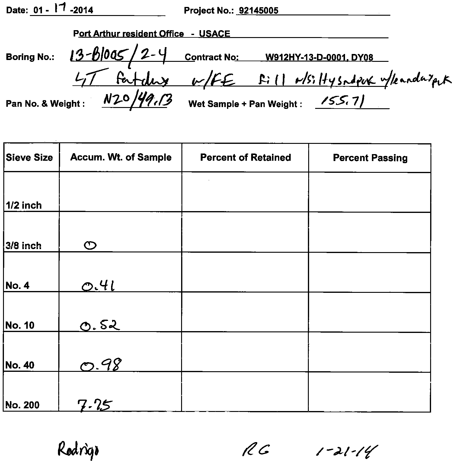
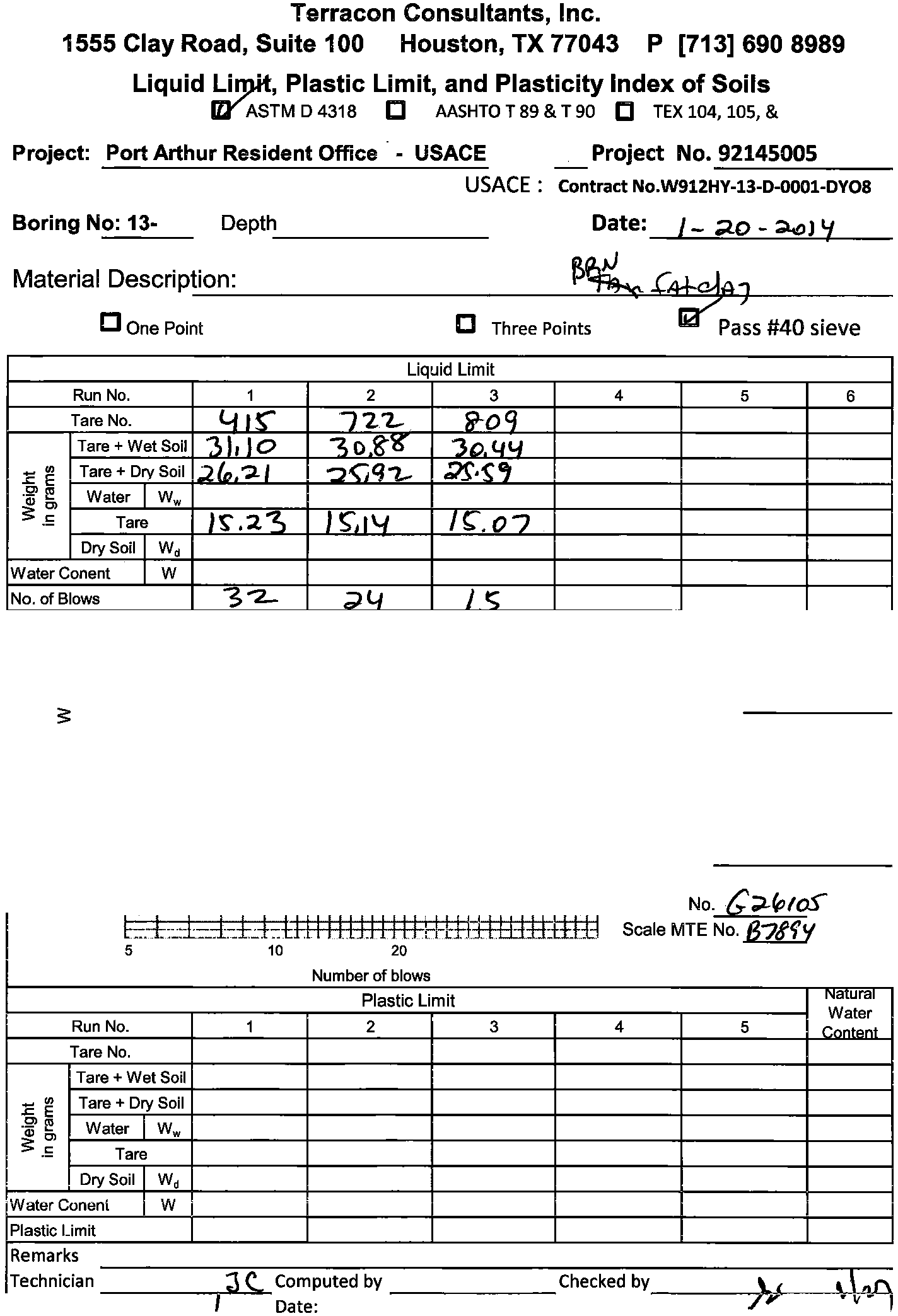
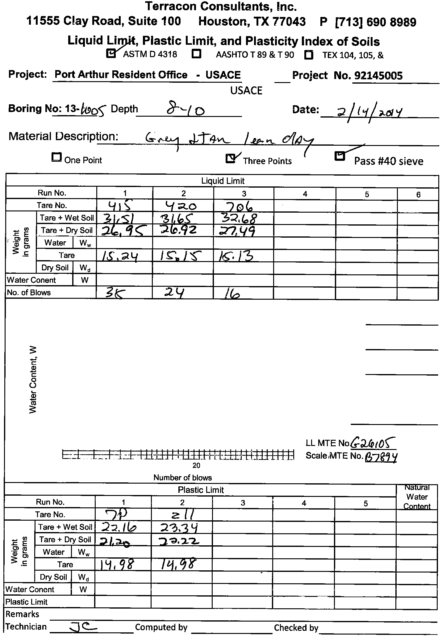
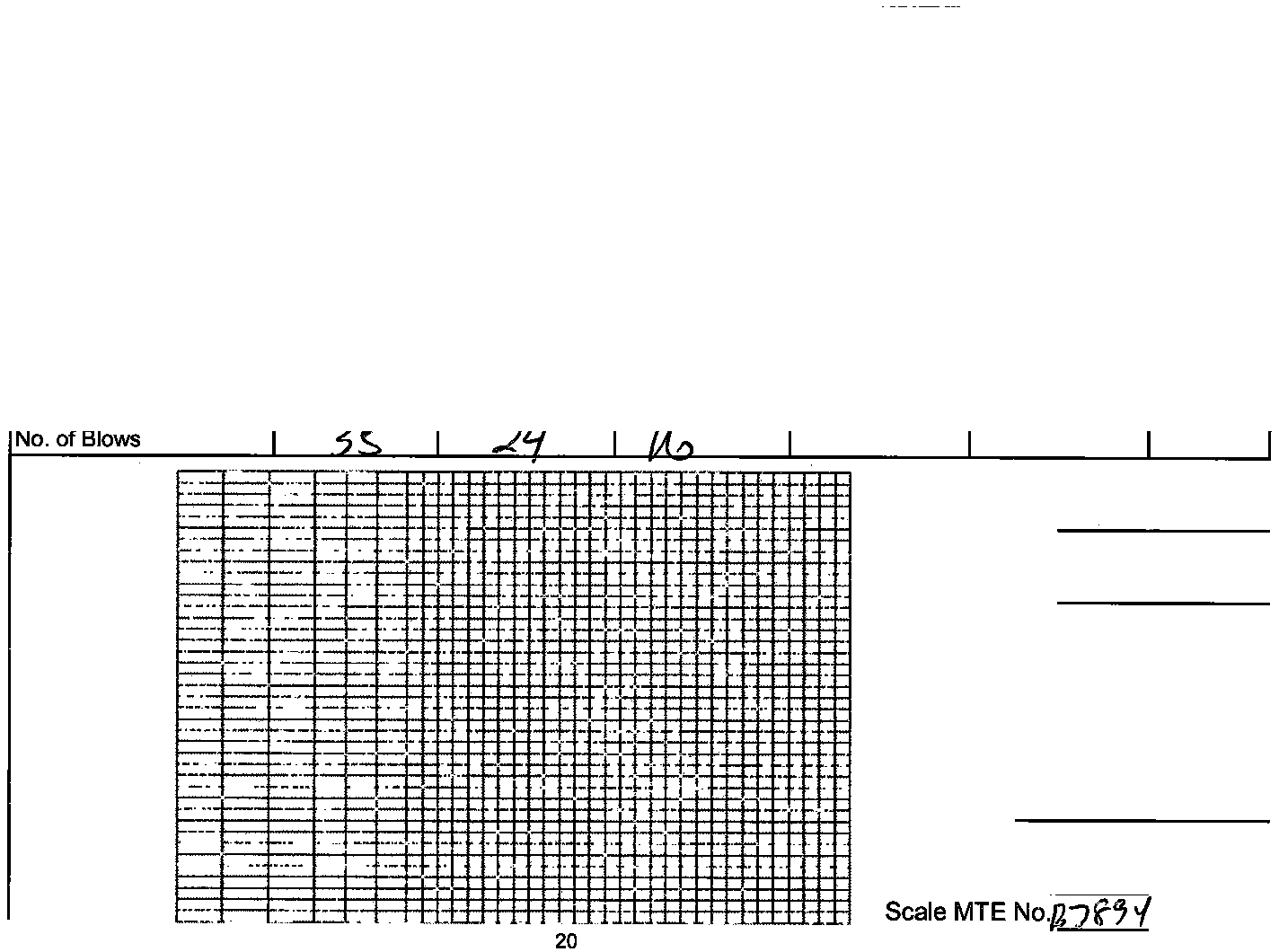
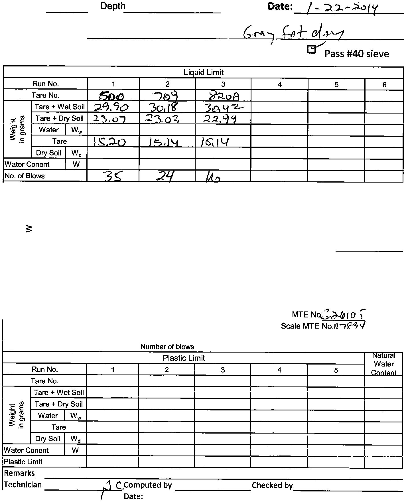
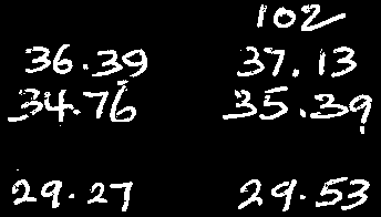
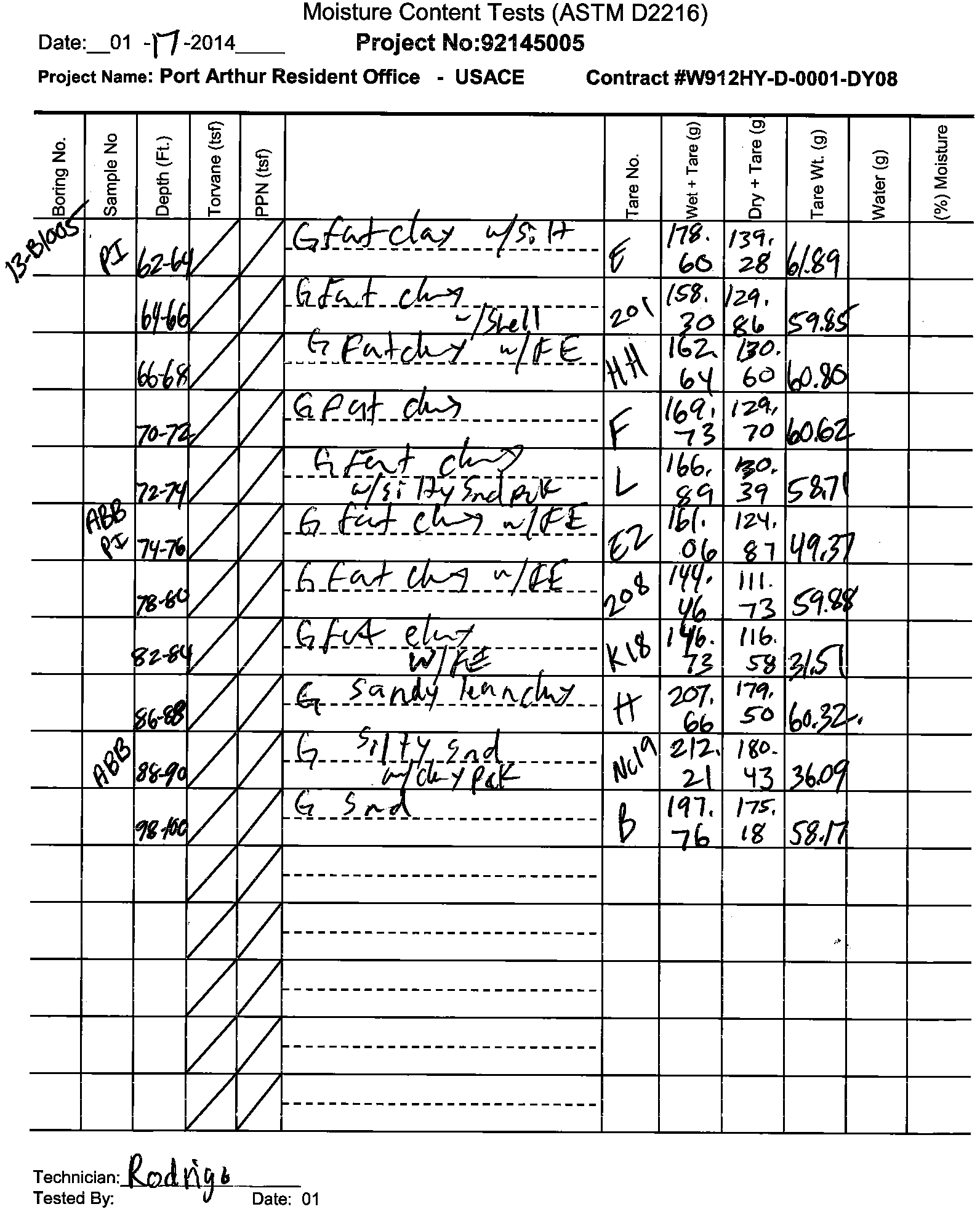
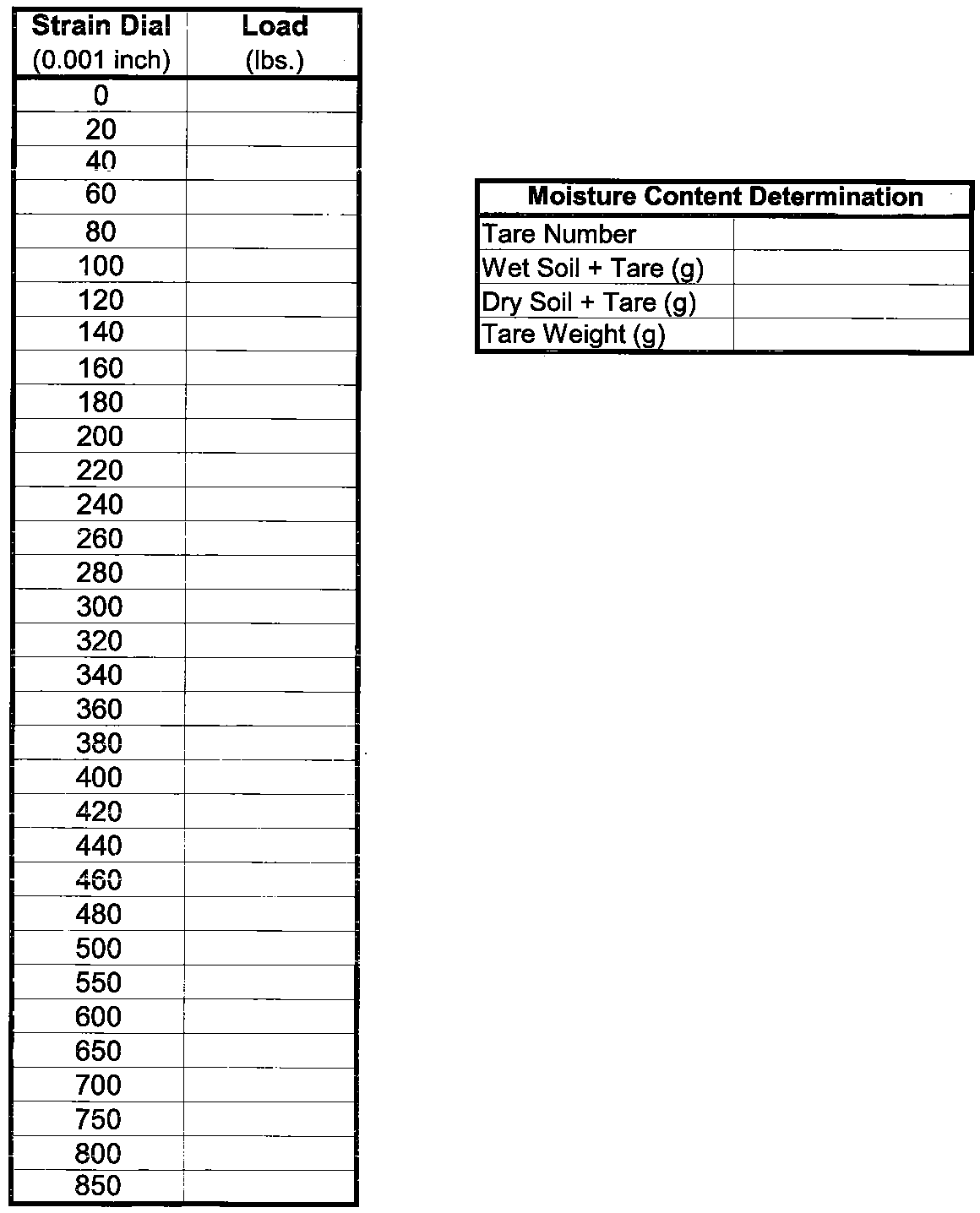
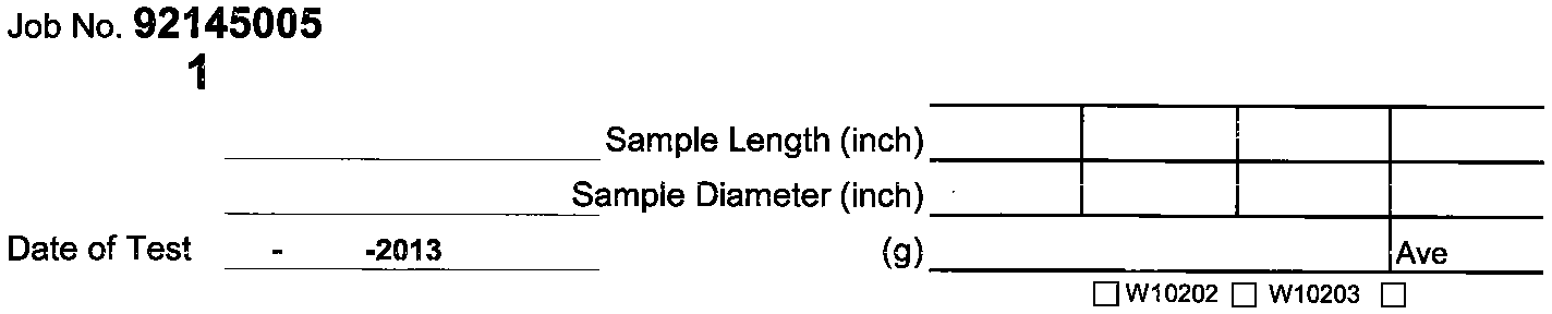
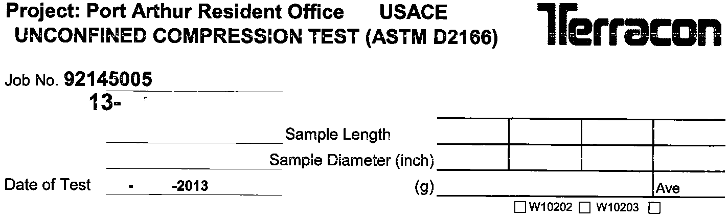
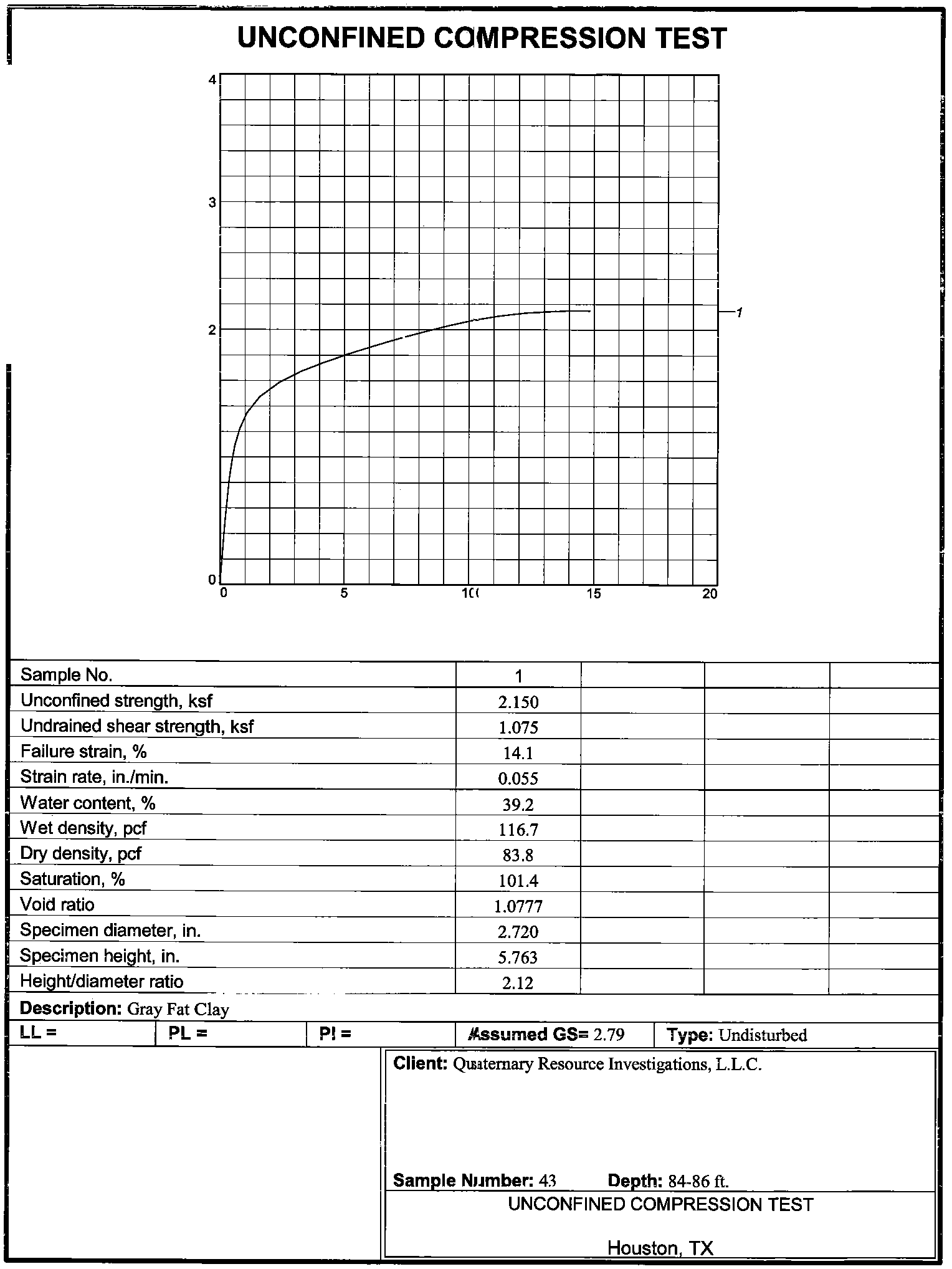
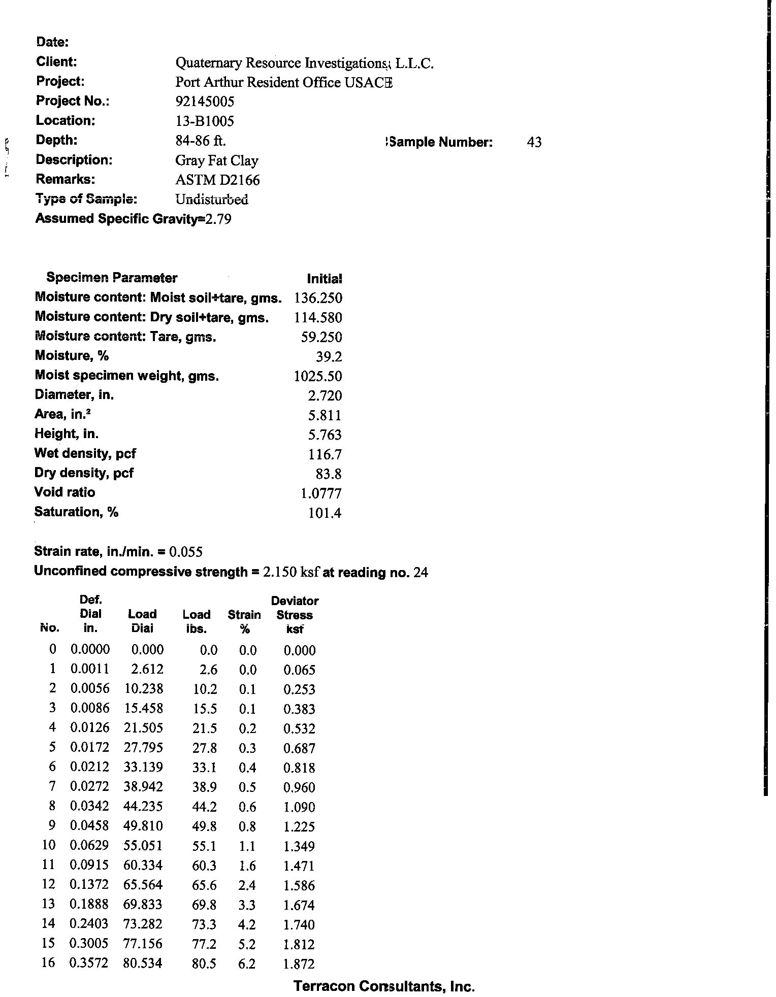
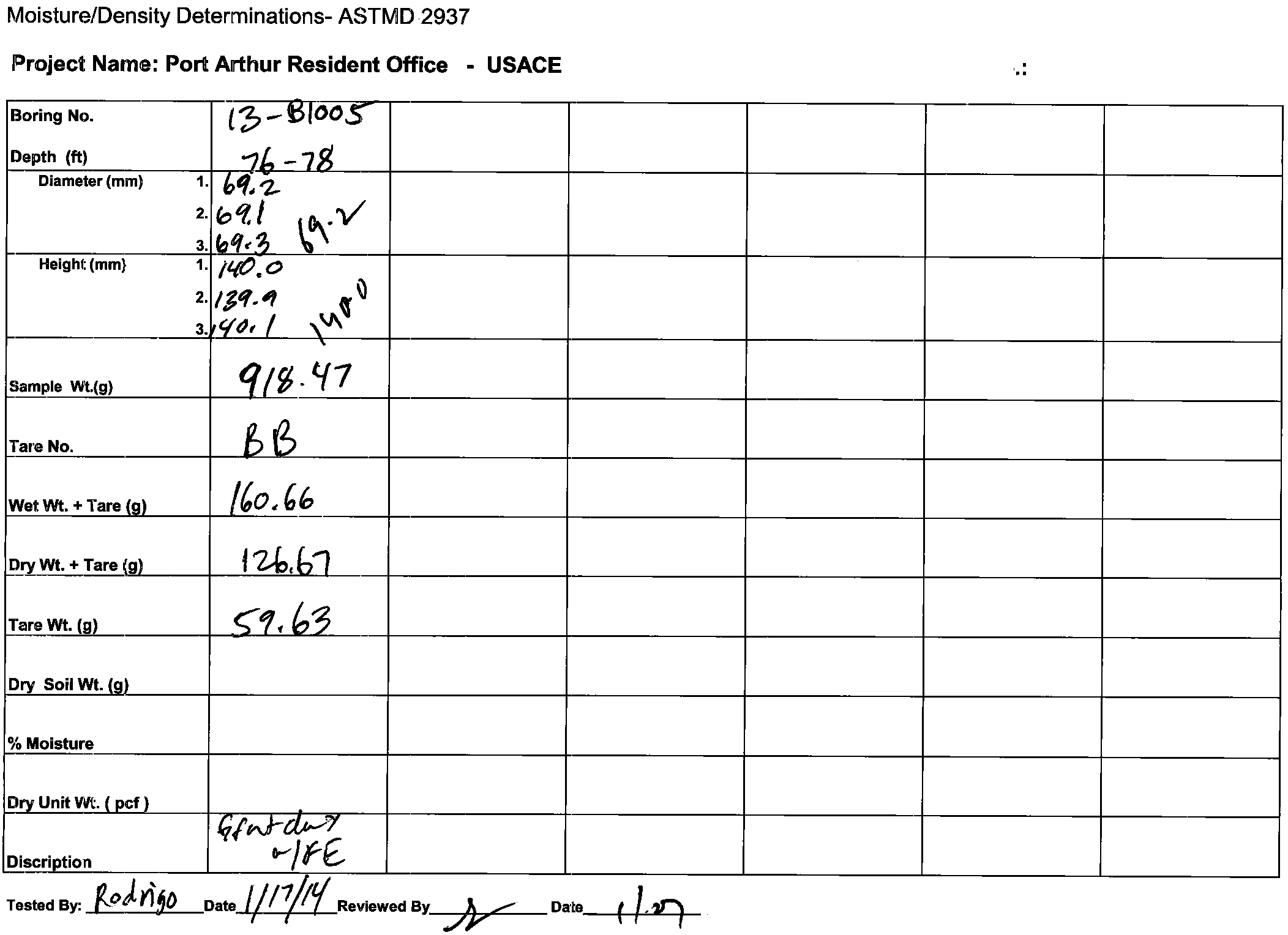
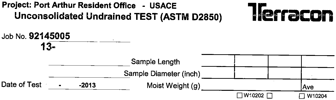
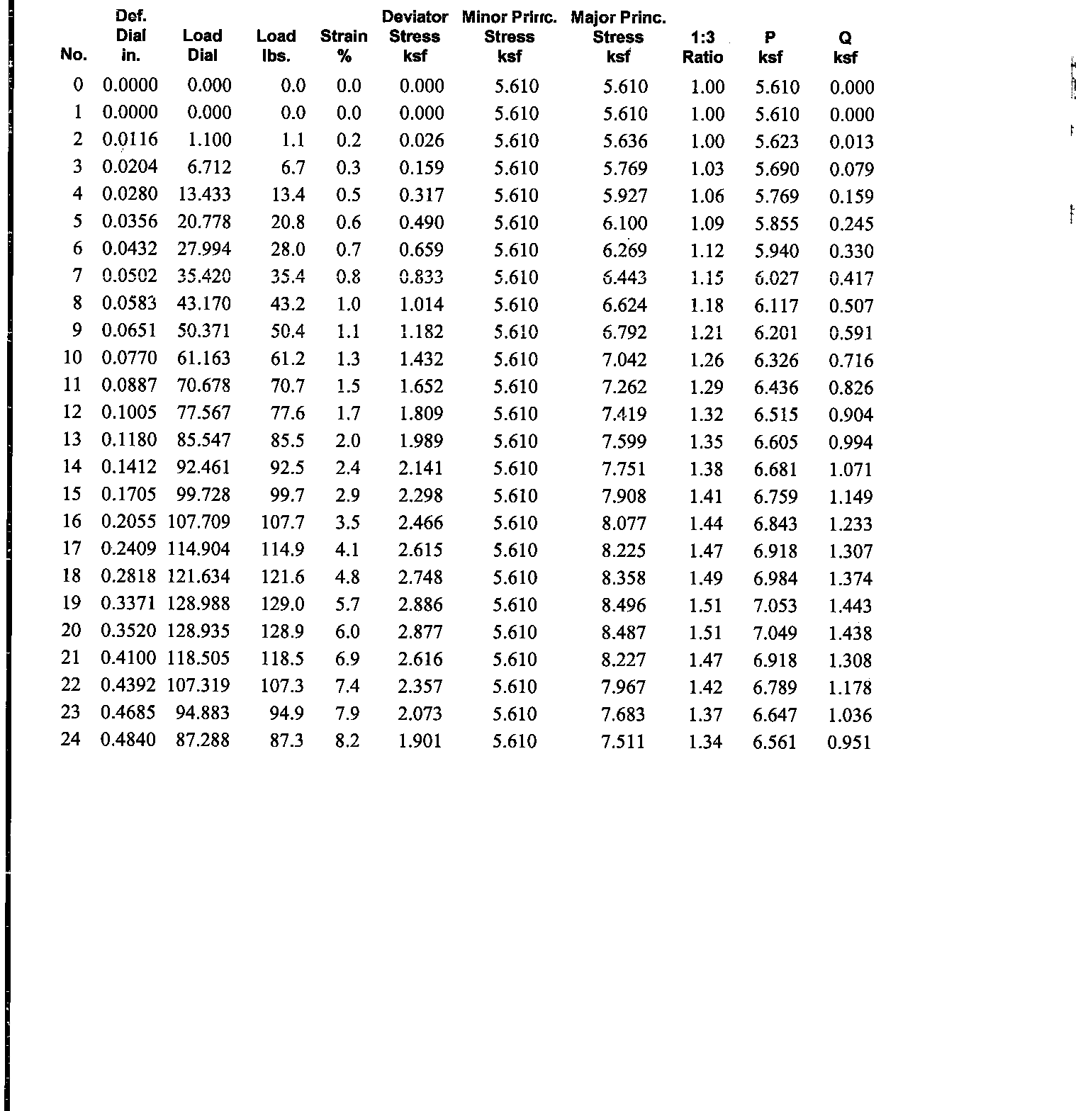
As per the Table of Required Services, test assignments were provided by the USACE POC as
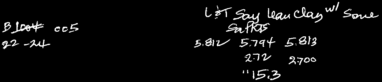
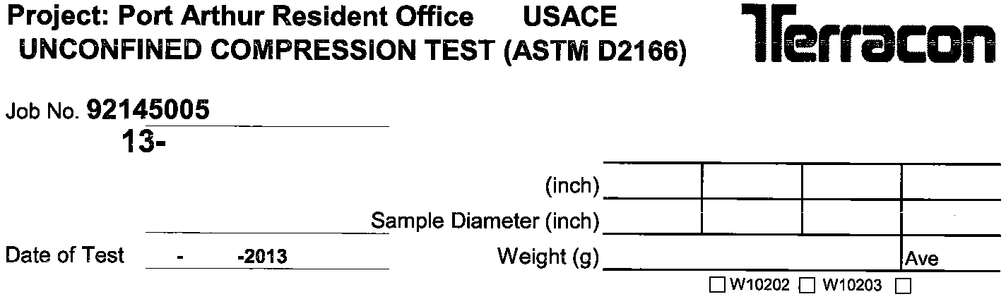
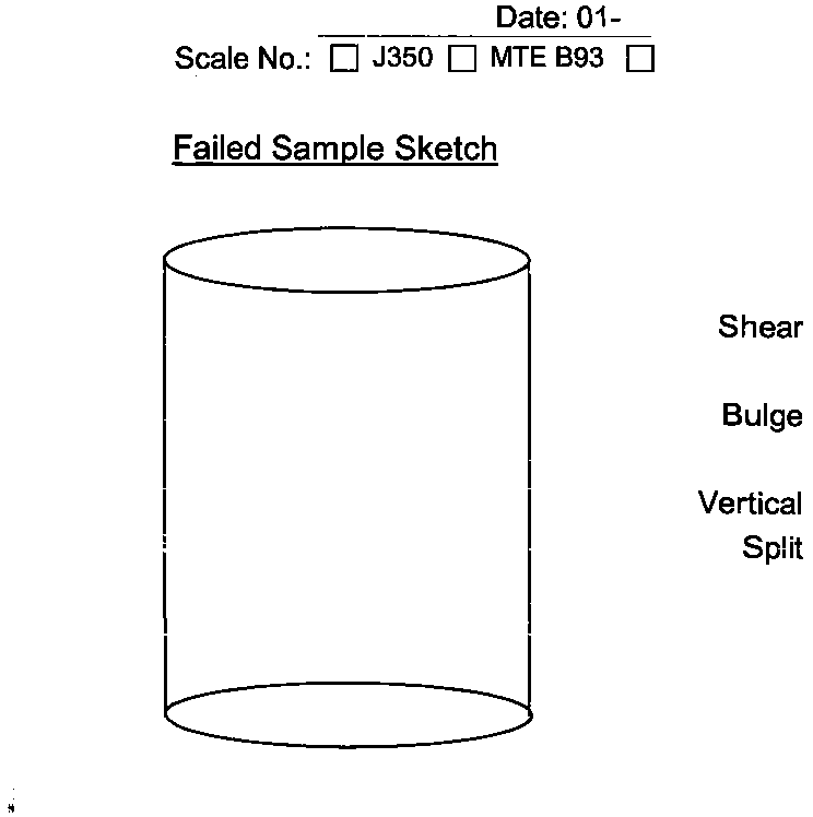
listed in Table 2. All tests were performed by QRI’s contract laboratory, Terracon Consultants,
Inc., on portions of the samples that were considered representative of the predominant
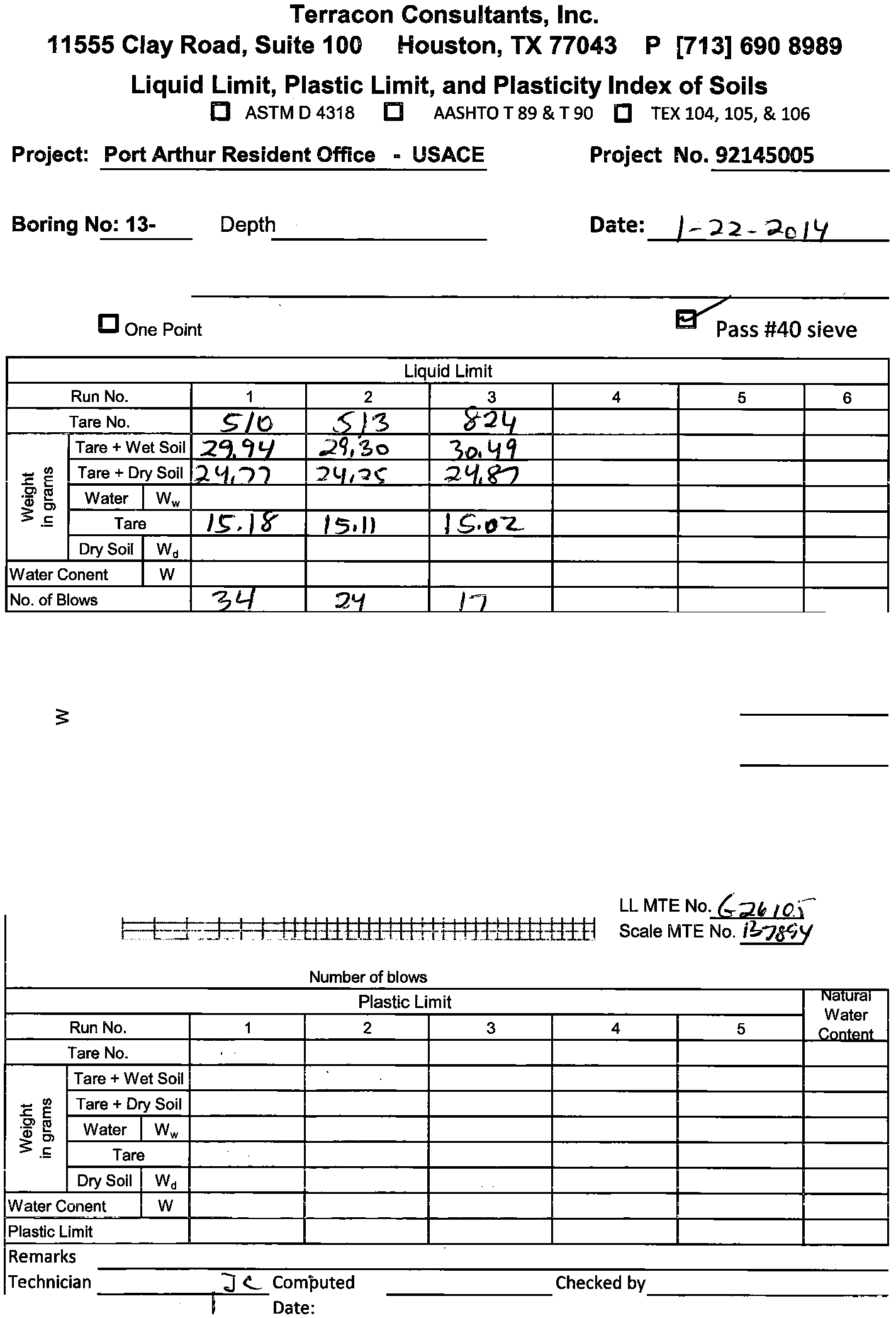
material composition of the overall sample. The laboratory recorded on the final summary
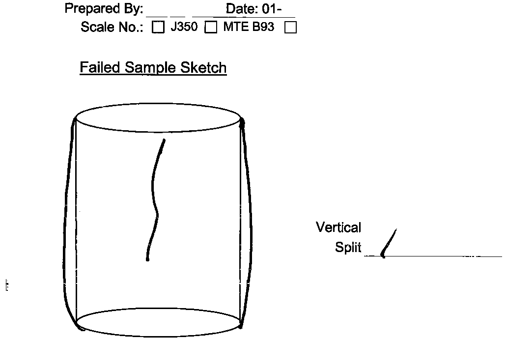
sheets the results of unit dry weight tests, moisture content tests, and visual classifications
incidental to performing unconfined compression tests, triaxial tests (including UU and CU
tests), and other tests. Results of moisture content testing and visual classifications incidental
to performing moisture content, unit dry weight, Atterberg limits, and sieve analyses, were also
included on the final test summary sheets provided by the laboratory. A complete set of
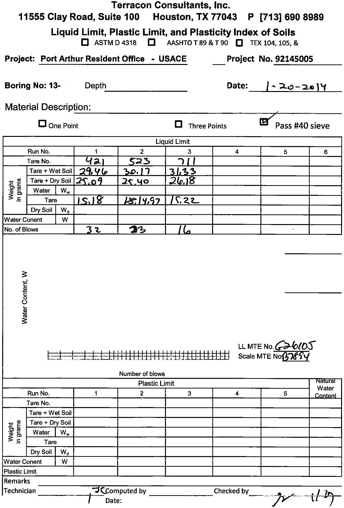
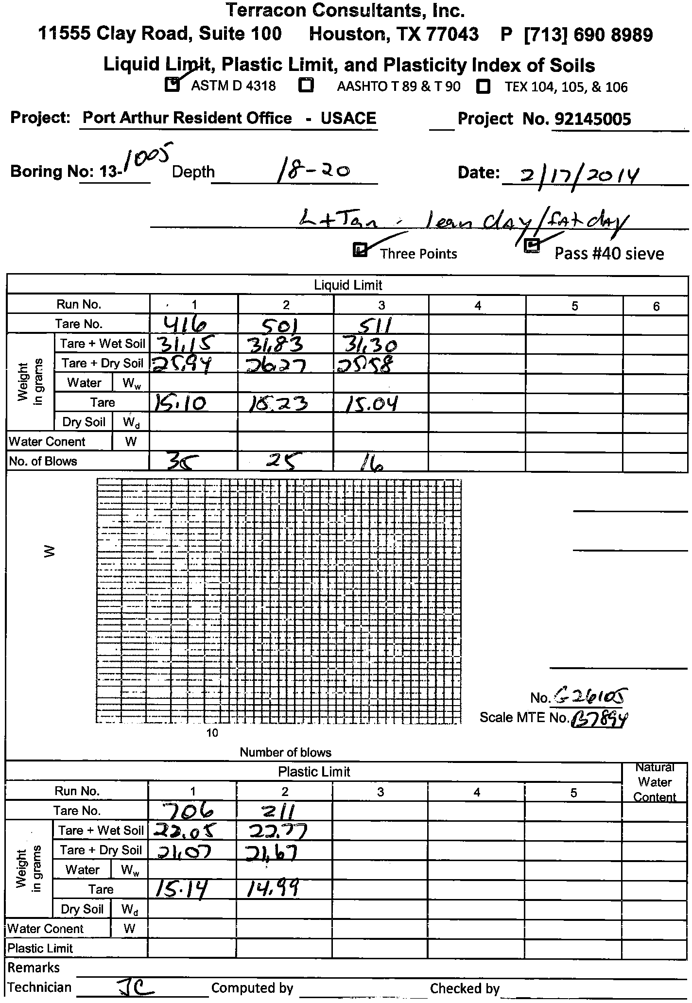
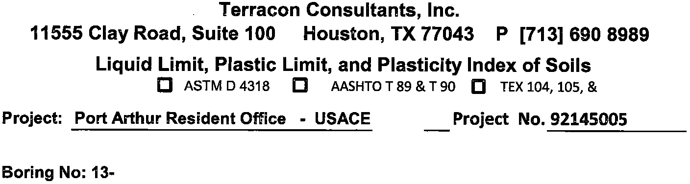
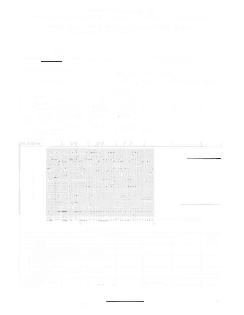
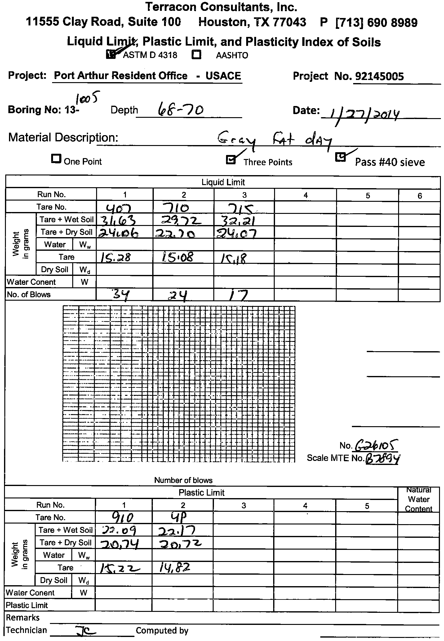
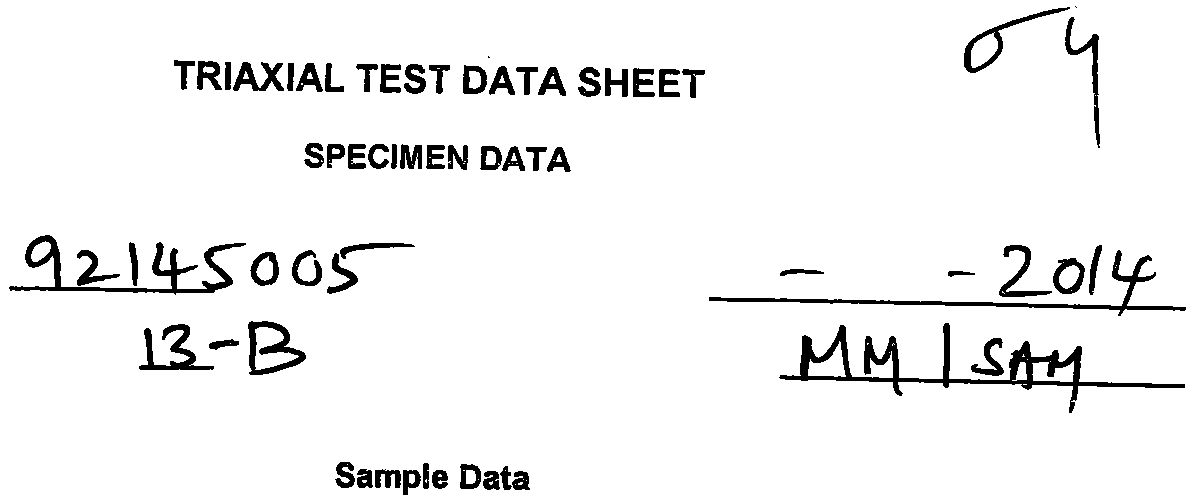
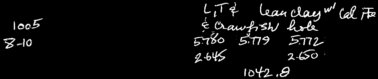
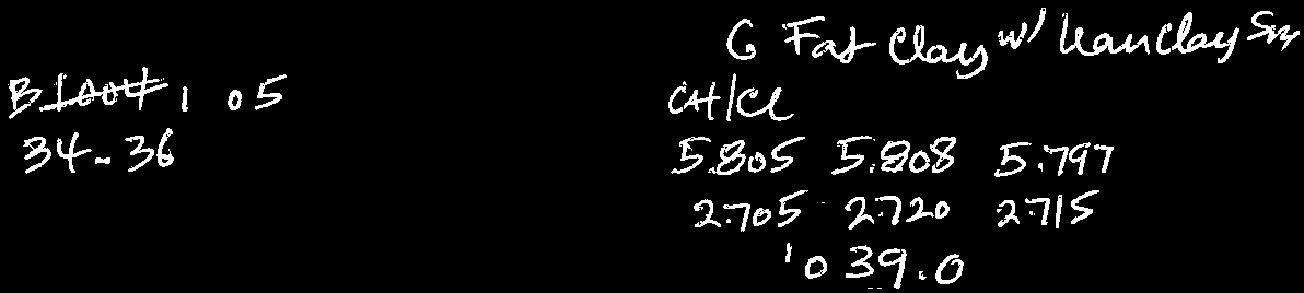
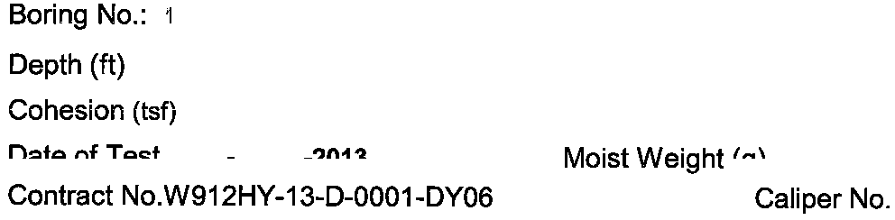
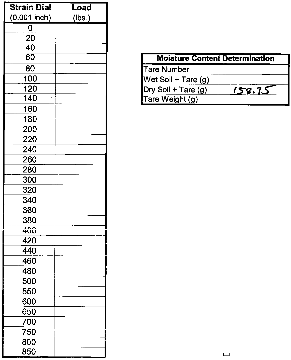
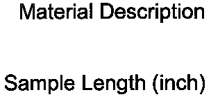
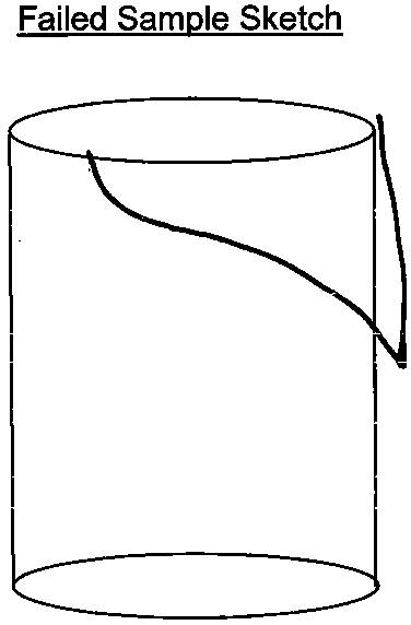
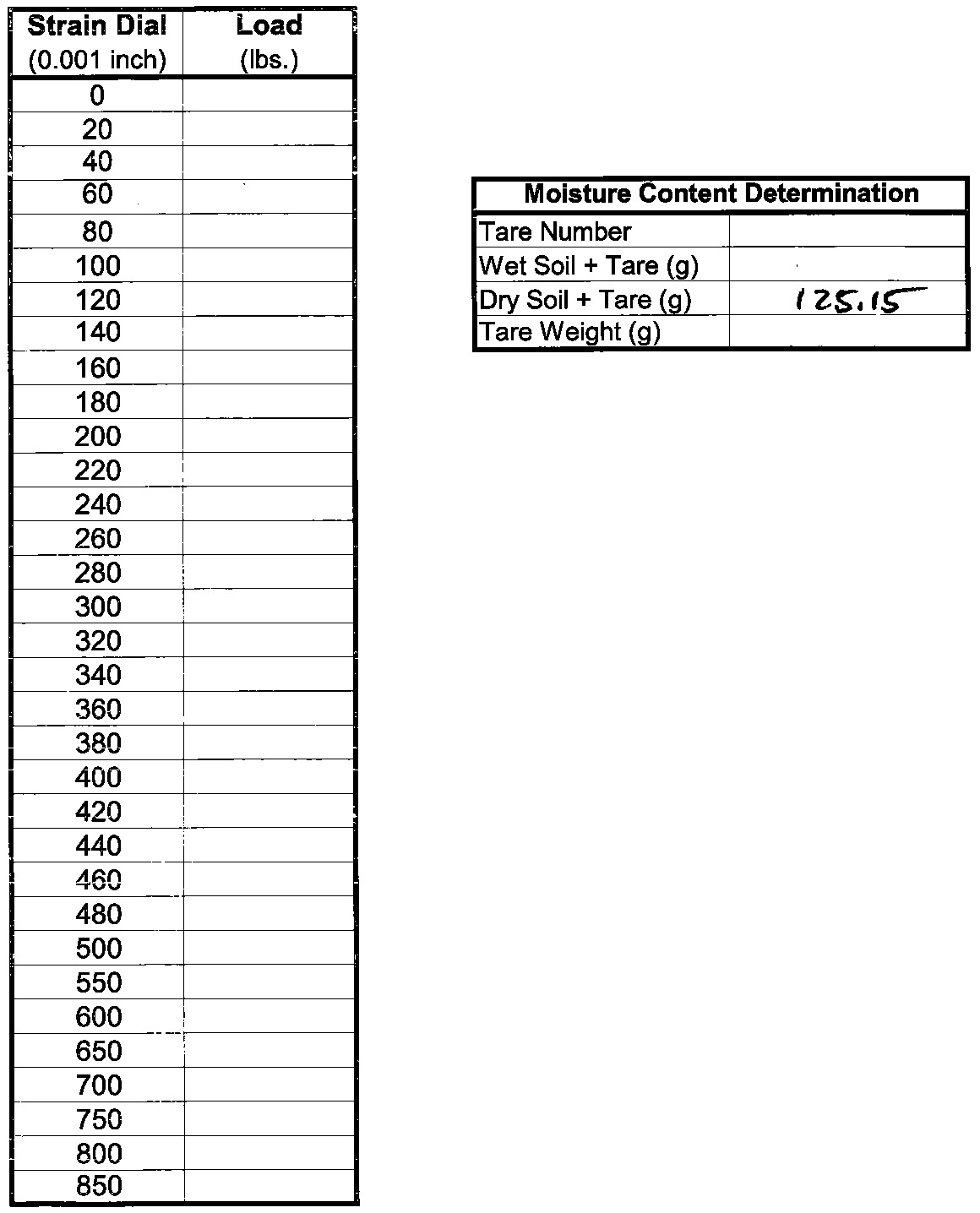
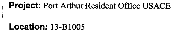
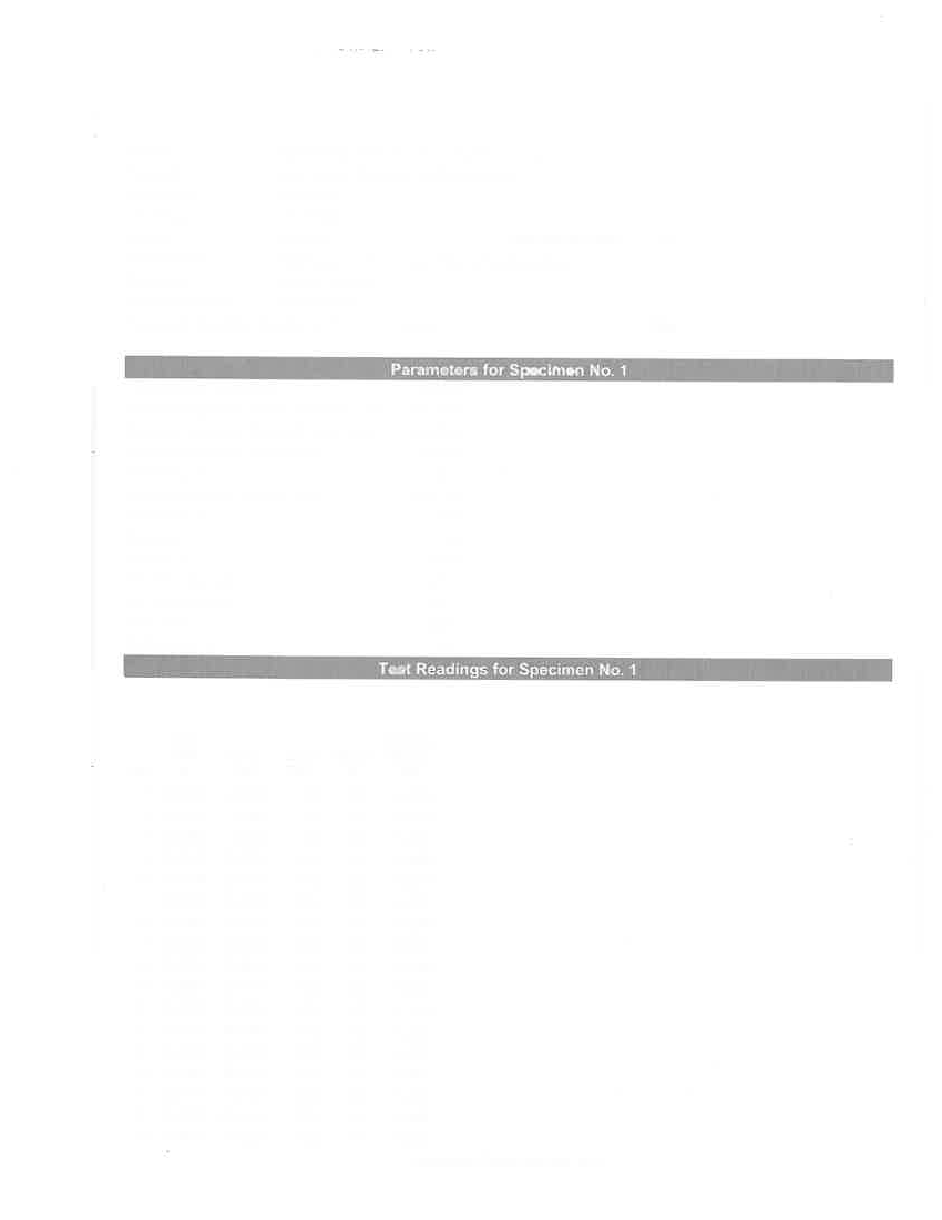
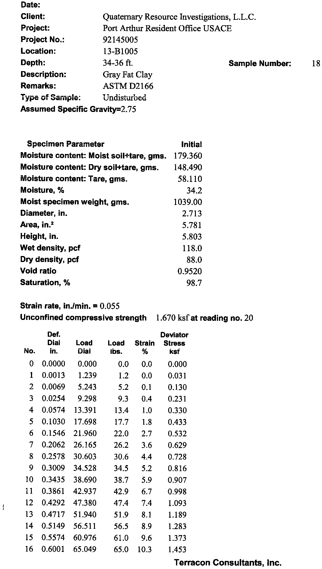
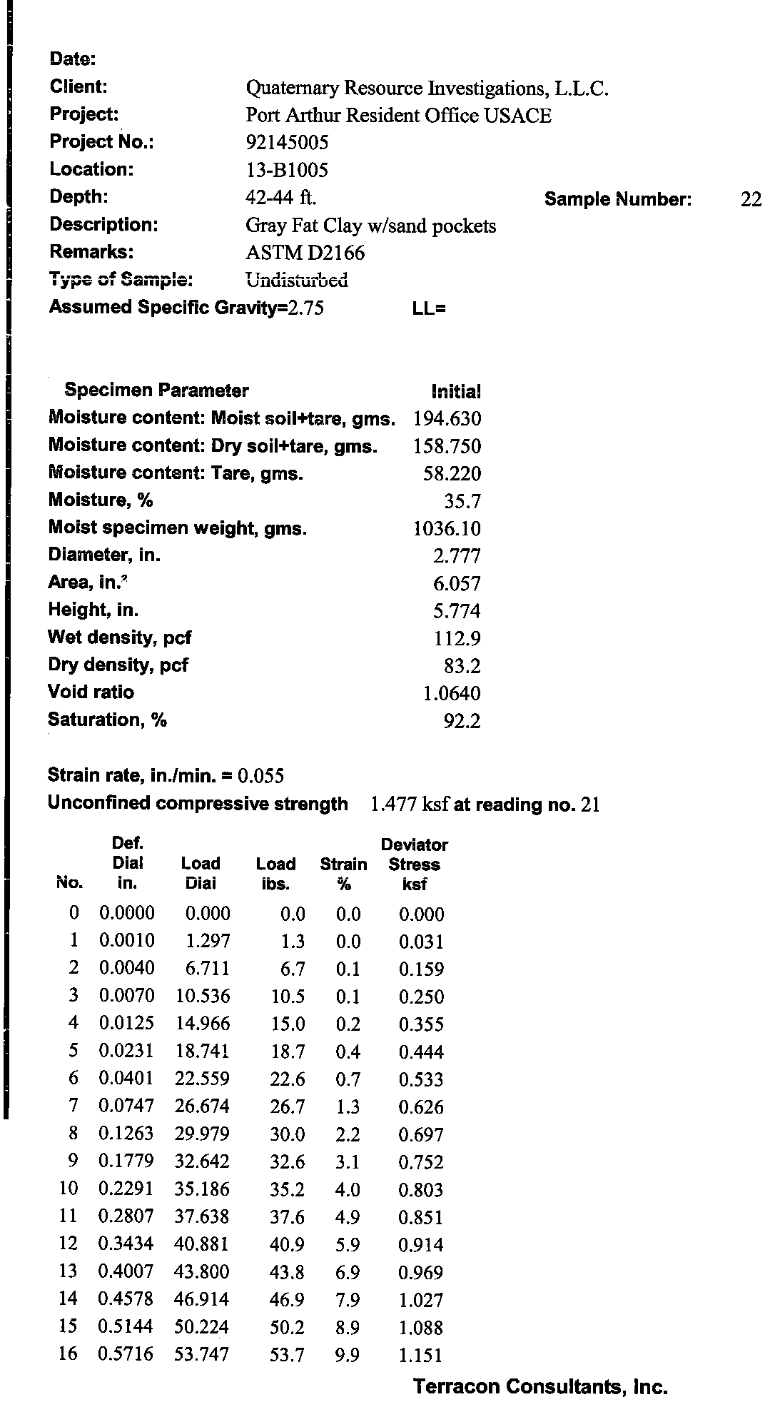
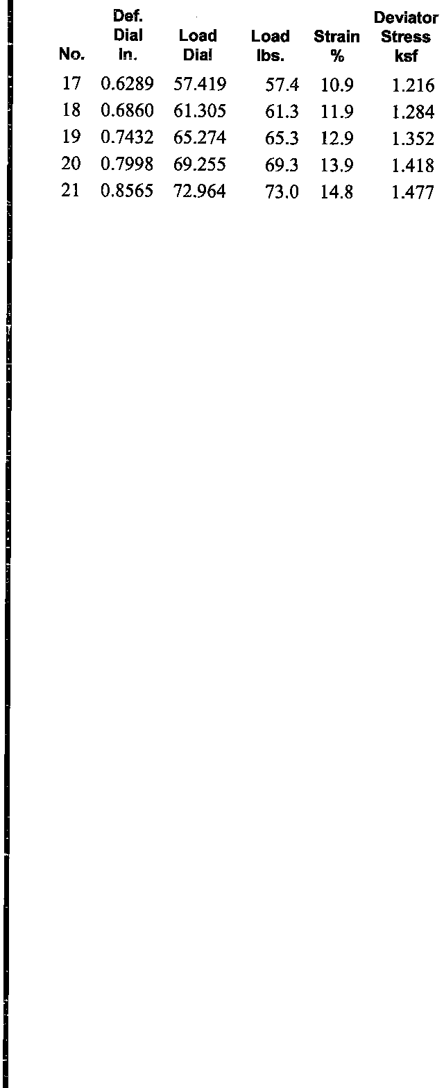
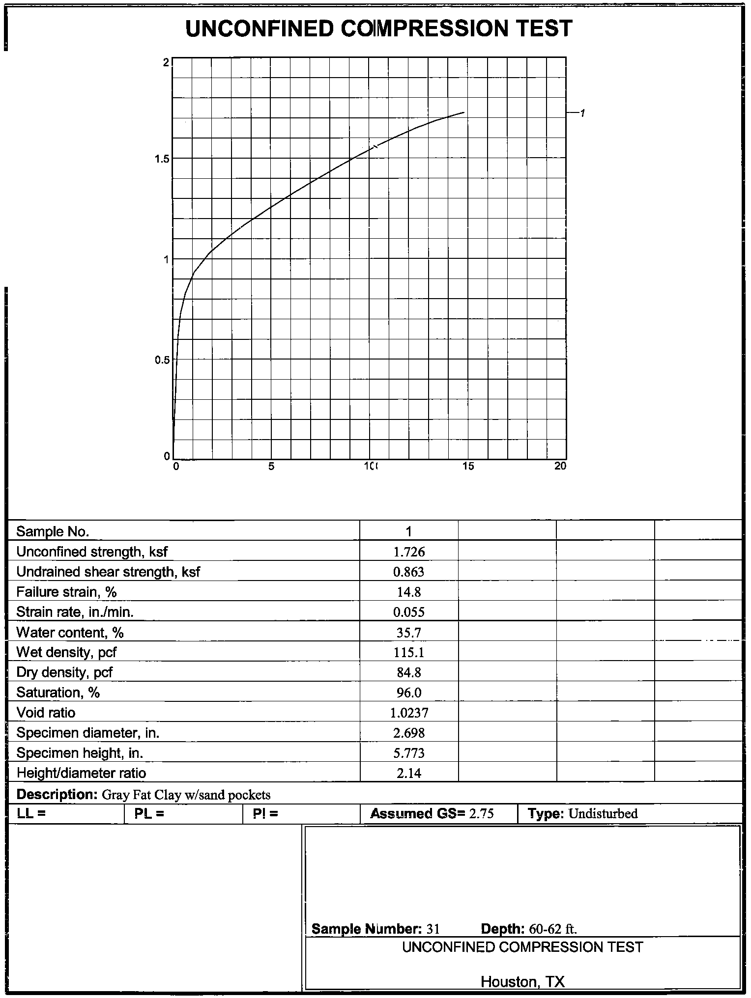
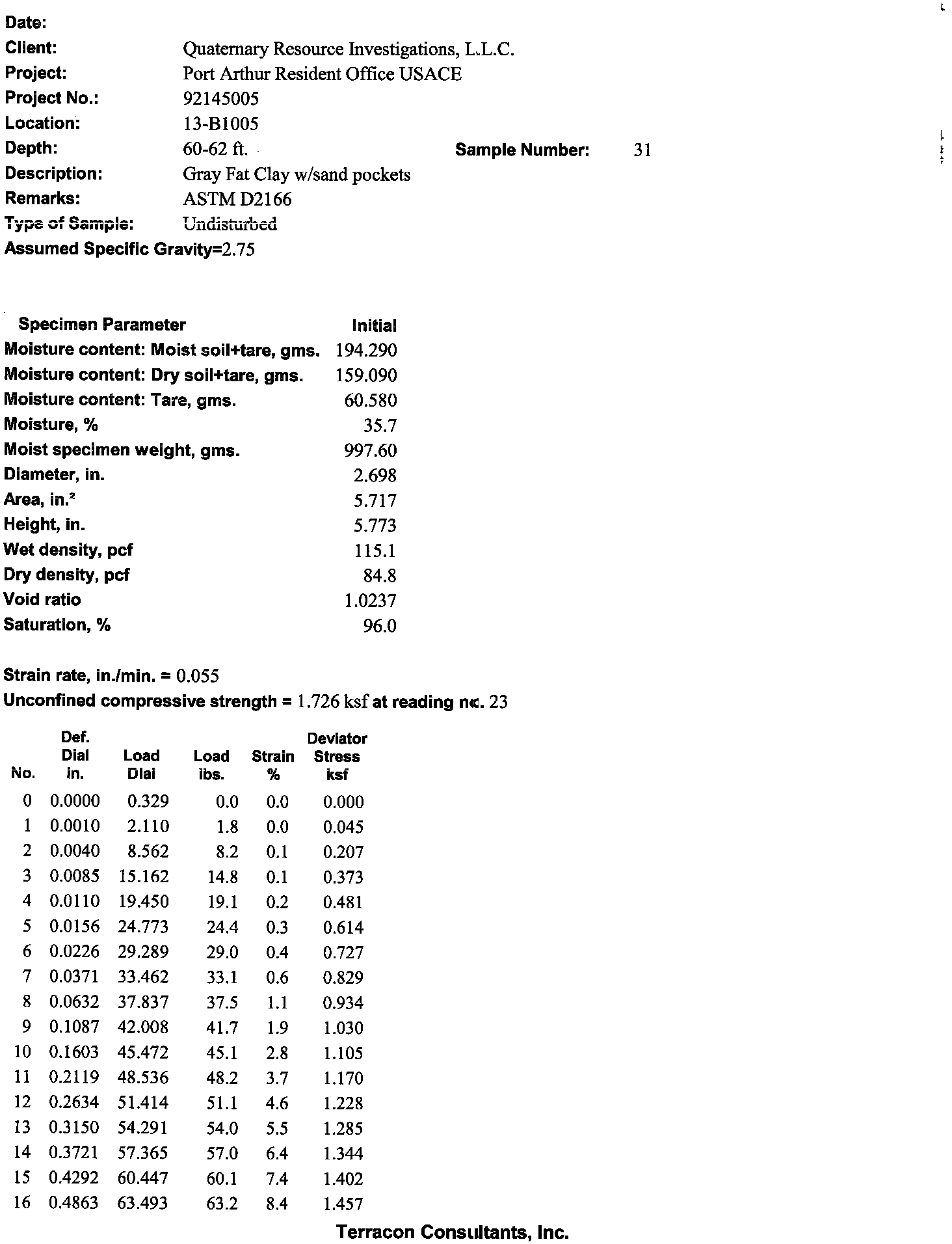
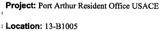
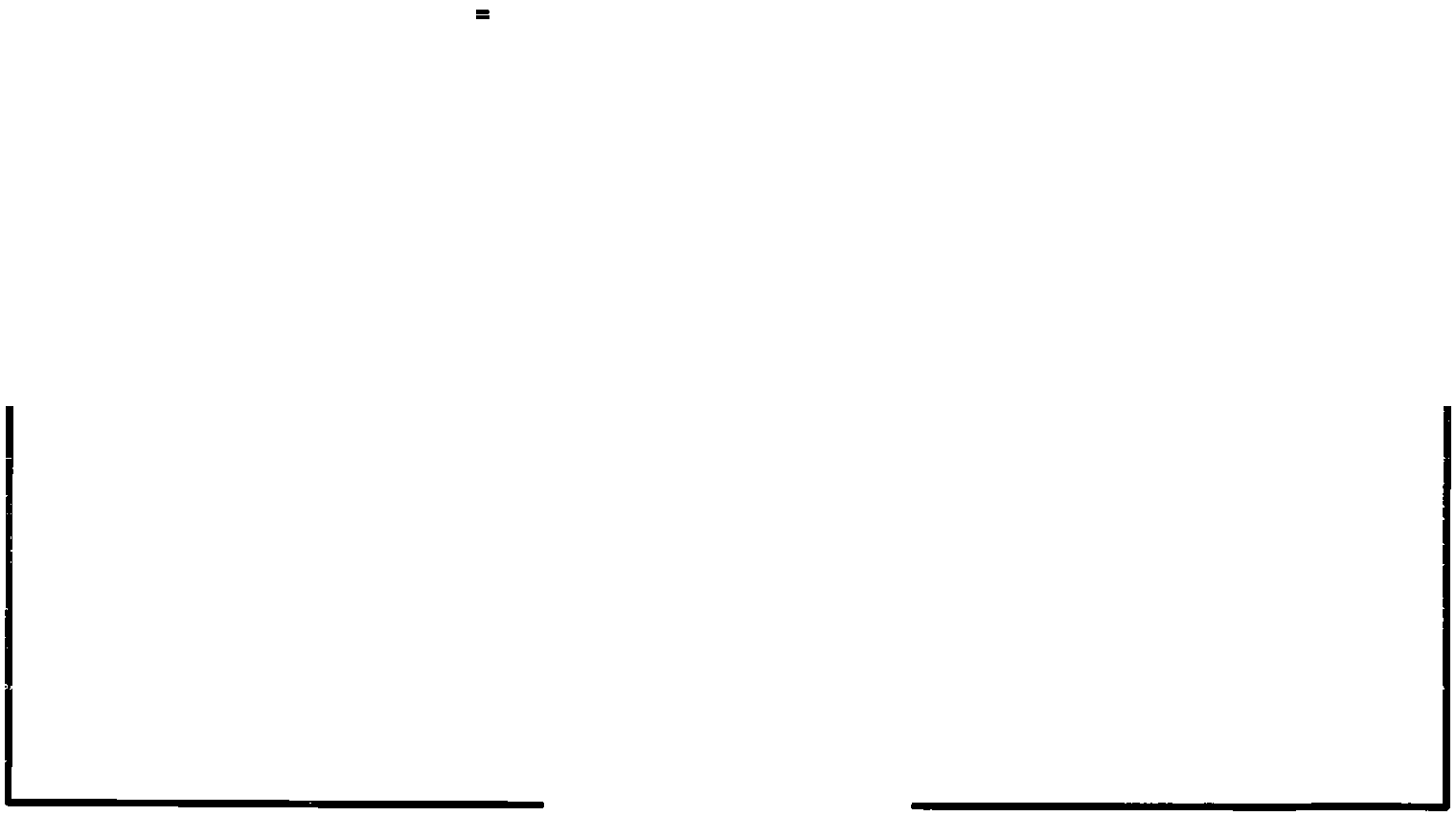
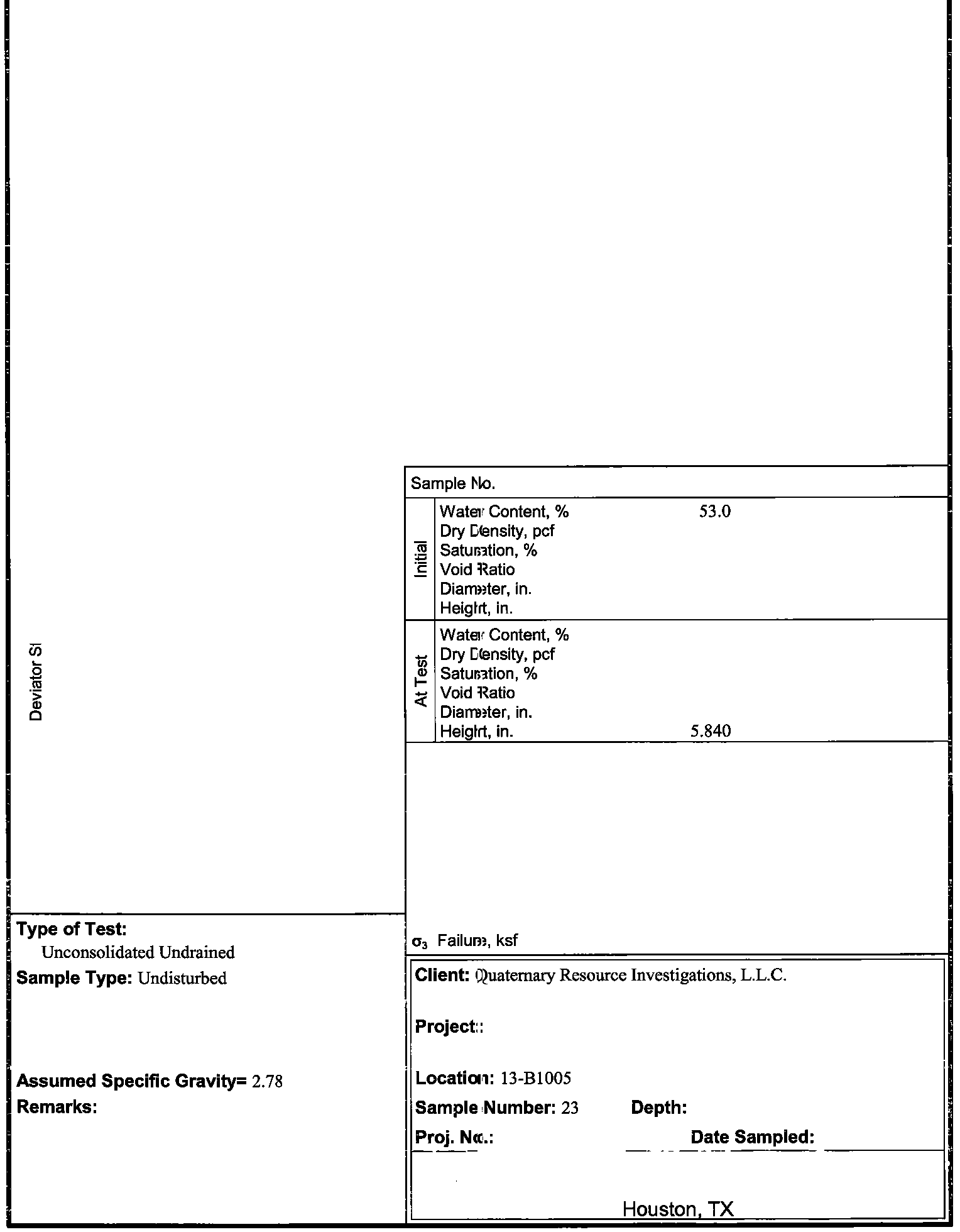
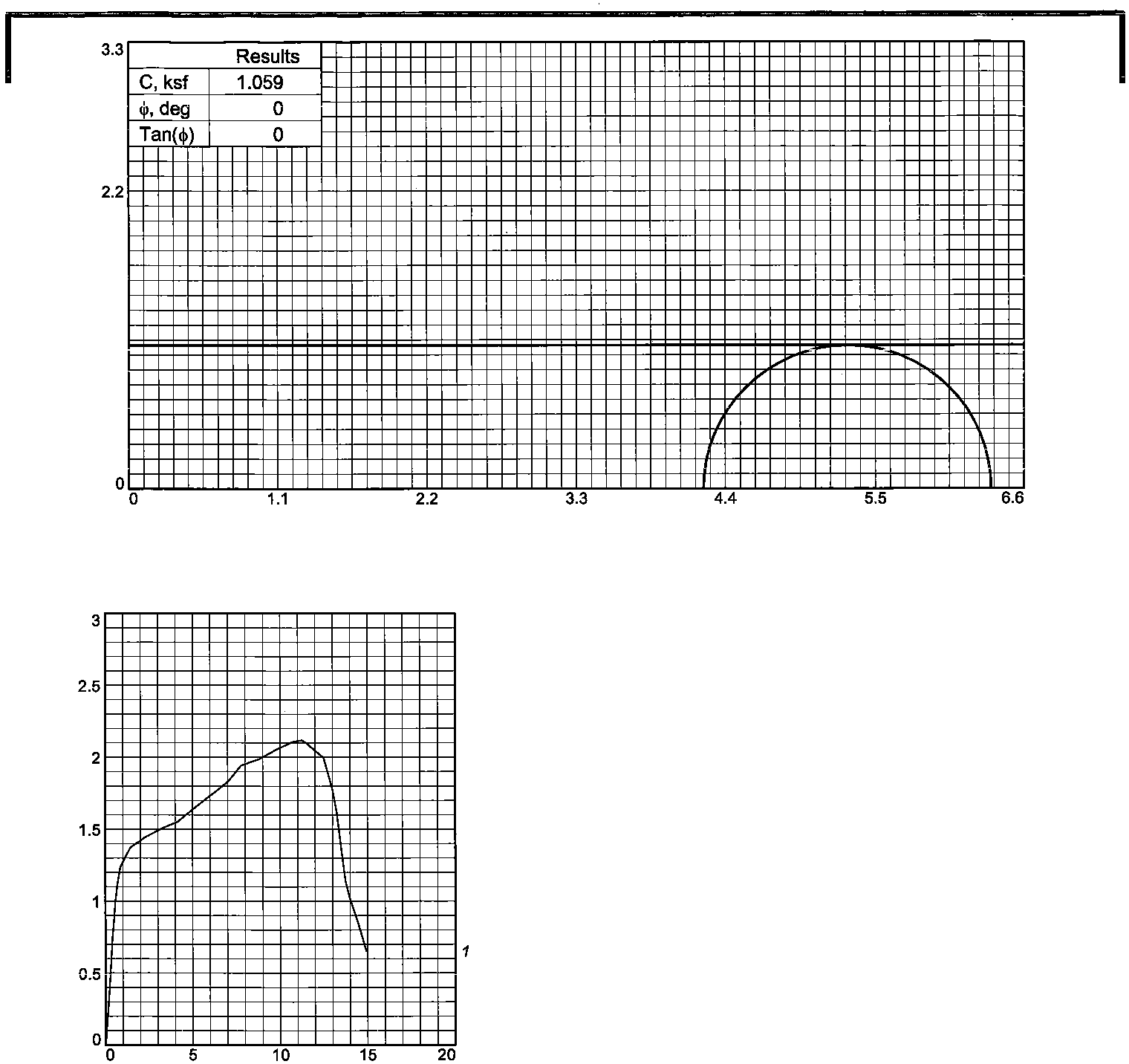
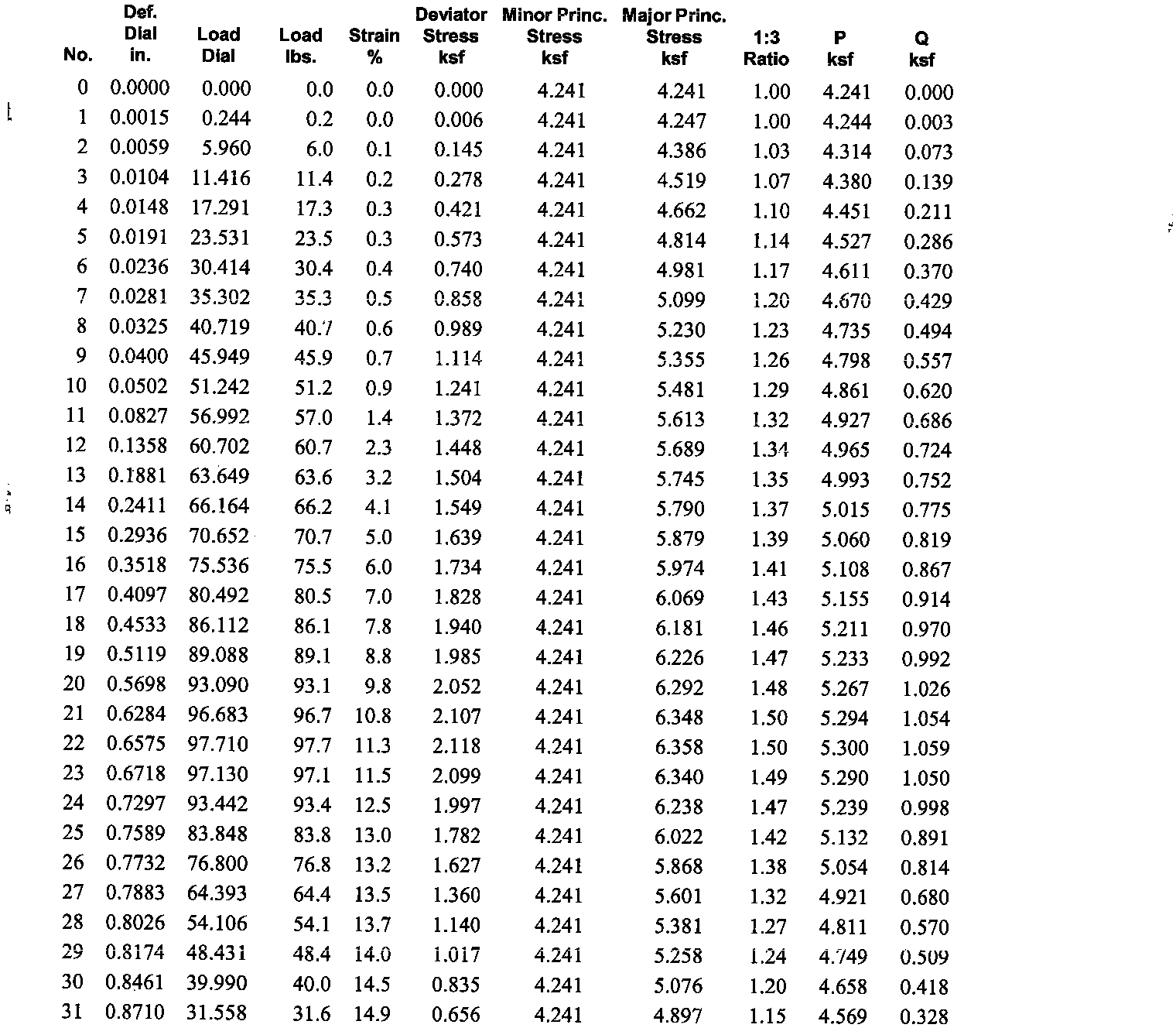
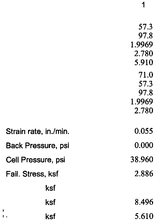
BORING ID:
BORING TYPE:
DEPTH:
100'
ELEVATION:
7.14'
X (US SURVEY FT):
3574844.09
Y (US SURVEY FT):
13898188.35
DEPTH TO WATER:
21.6'
PORT ARTHUR RESIDENT OFFICE
BORING SUMMARY SHEET
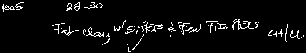
13-1005
Continuous Sampling
5
7.143'
5
5
5
5
9/10/24
3/8 4 10 40 100 200 gravel sand silt clay
sieve 200
C Wc γdC Wc γd C φ Wc C φ c̕ φ̕Wc γd
ft tsf tsf bl/ft % % % %%%%%% % % % % % %pcfksf % pcf ksf%pcf ksf
º
% ksf
º
ksf
º
%pcf
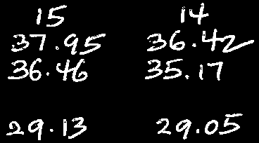
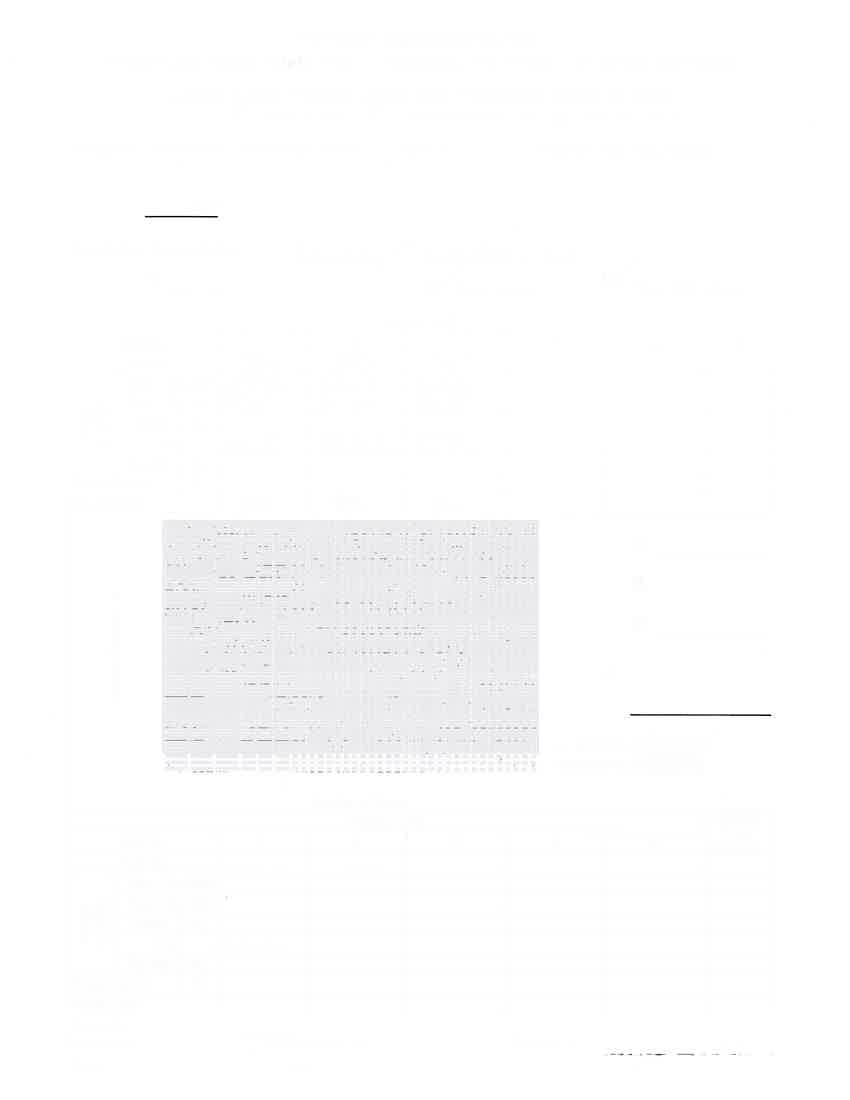
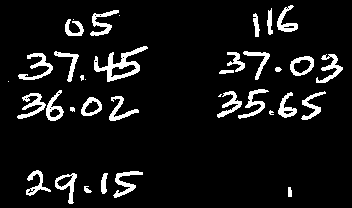
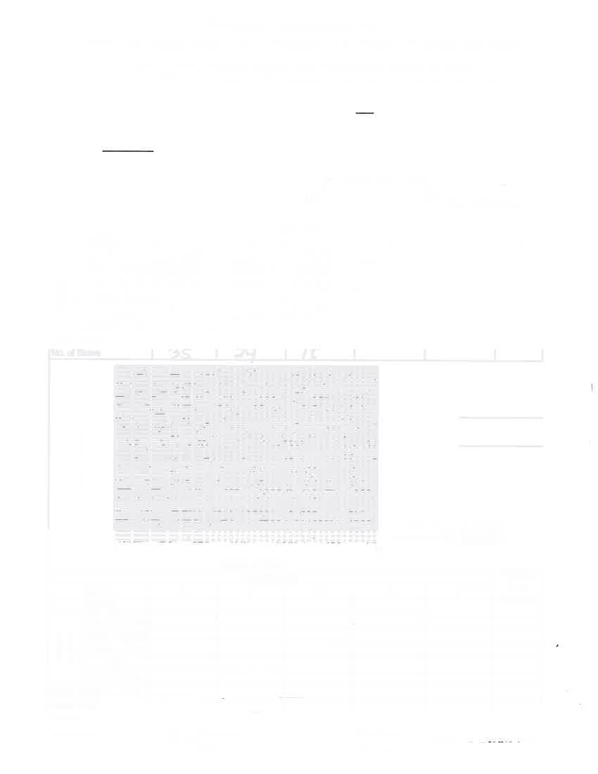
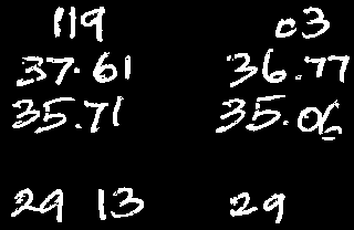
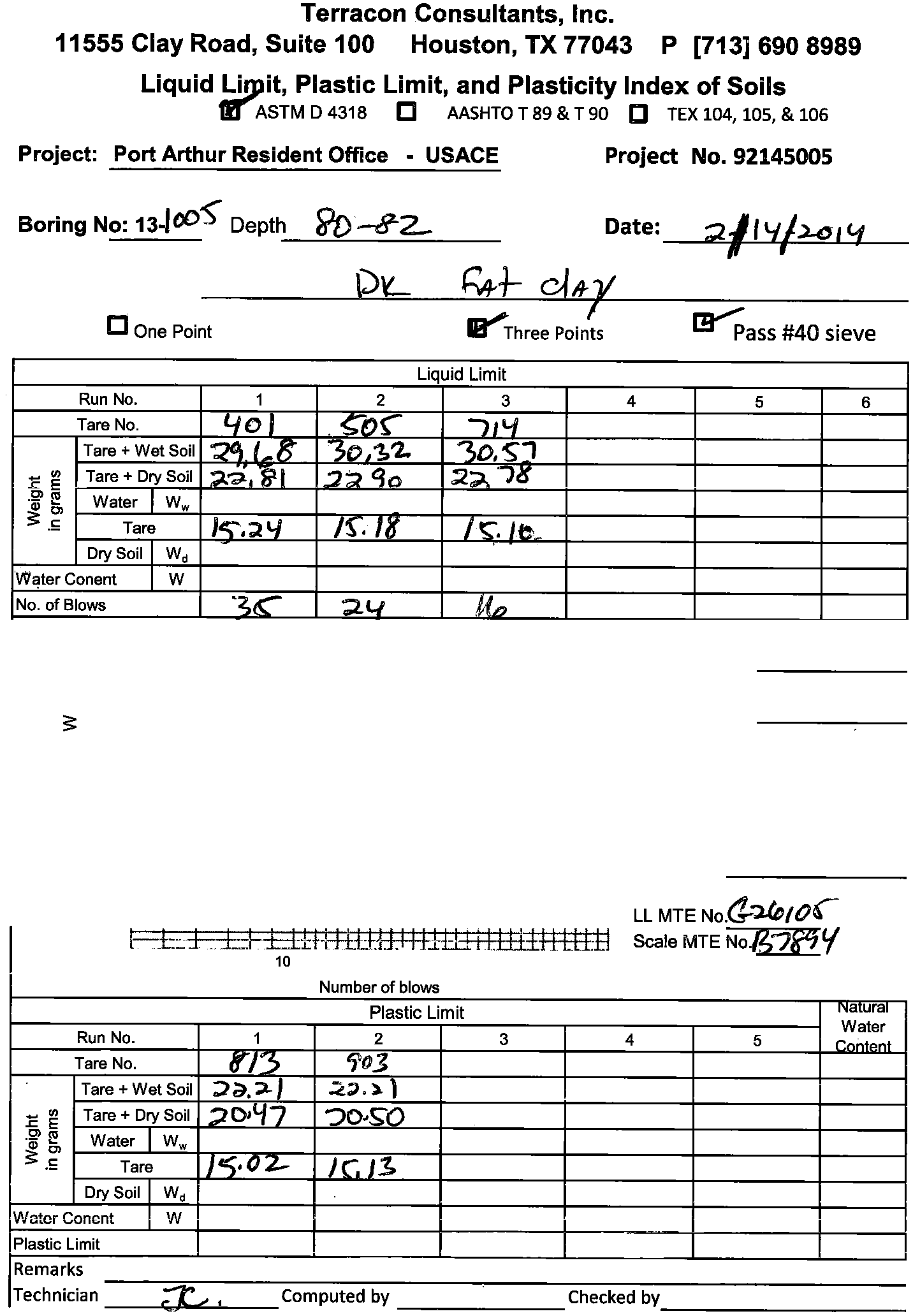
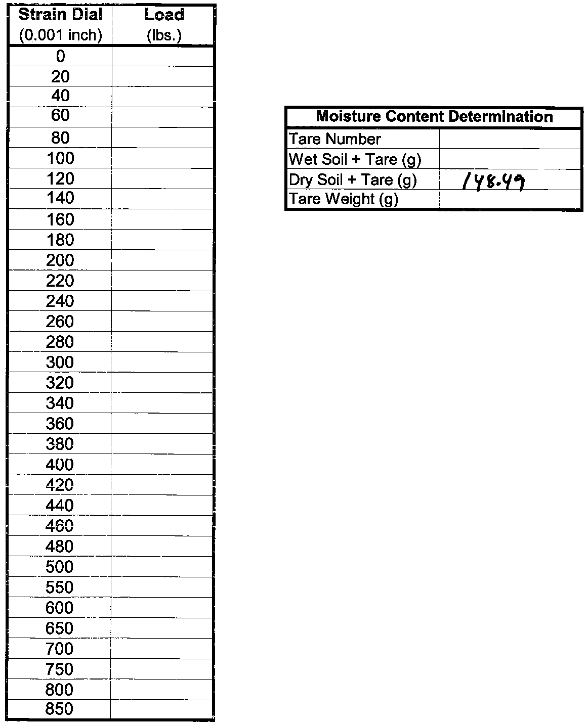
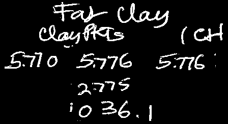
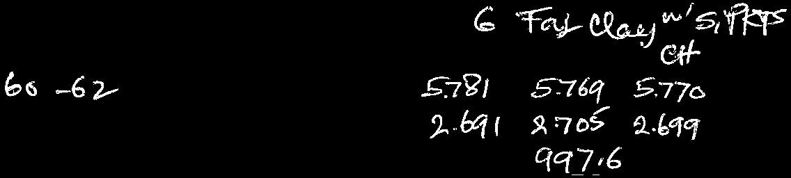
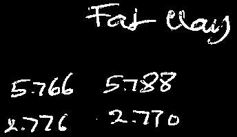
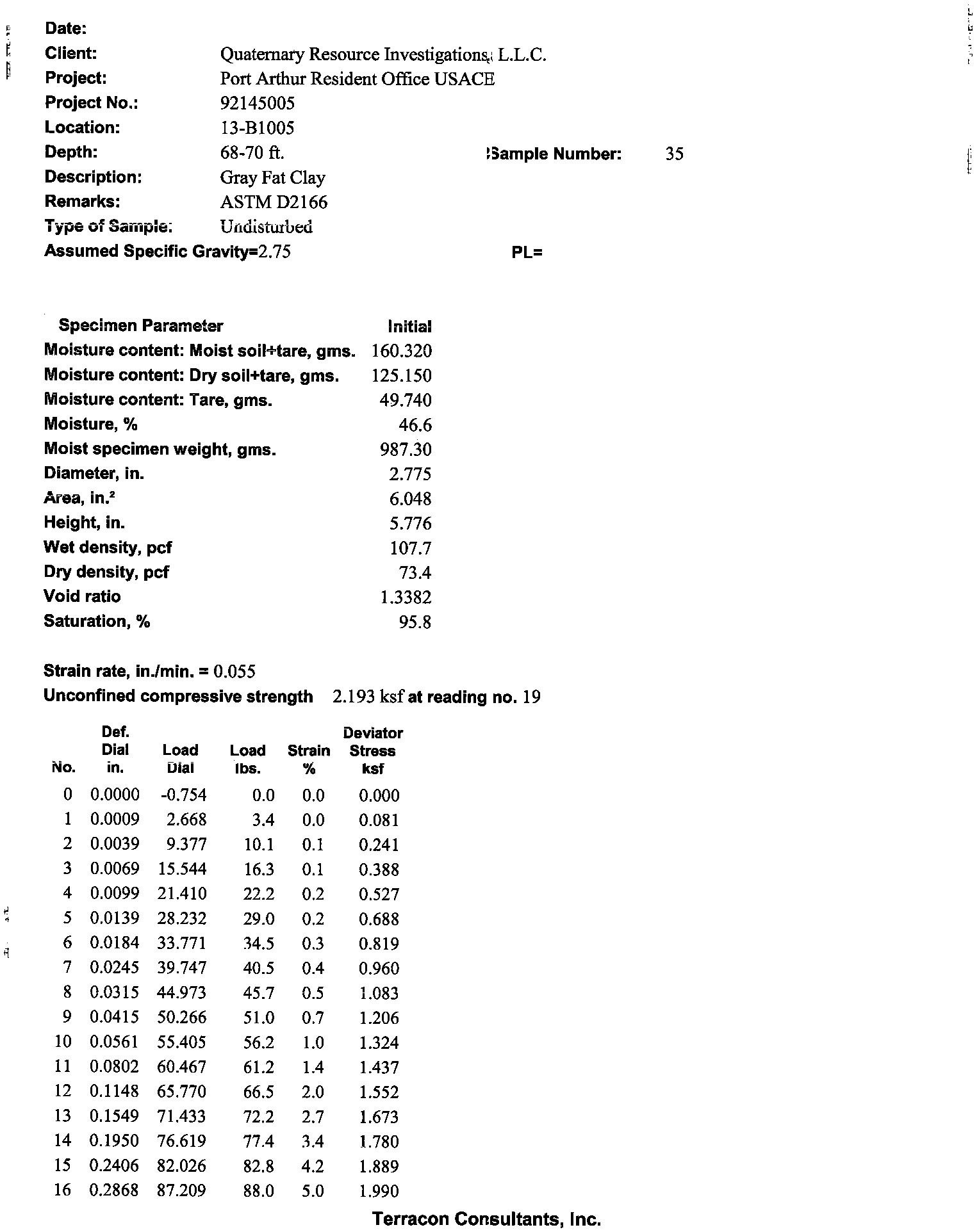
SUMMARY TABLE OF LABORATORY TEST DATA
Project Name: Port Arthur Resident Office
Client: QRI
Terracon Project # : 92135321
Boring
Depth
Field Tests
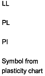
Atterberg Limits
Grain Size Analysis
USCS
Symbol
PP
TV
SPTn
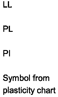
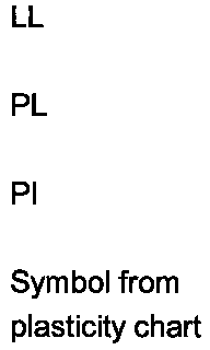
LL
PL
Symbol
Symbol
Symbol
Symbol
Wc
γd
Strenght Tests
Soil Particle Content
Unconfined Compression
UU Triaxial Test
Direct Shear
CU Triaxial Test
PI
% by weight passing sieve
0-2
3.0
27
2-4
1.9
45 20 25 10010099 99 91
1 9
91 CL
25
4-6
1.5
43
84
6-8
1.5
27
8-10
1.75
40
15
25
CL*
28
98
0.50
28
98
CL**
10-12
2.75
45 16 29 10010097 94
87
0 13
87 CL
21
12-14
2.7
22
14-16
2.2
29
16-18
2.75
29
18-20
1.75
51 16 35 100100 99 99
81
0 19
81 CH*
22 106
2.16 22106
CL**
20-22
2.25
22
107
22-24
2.4
32
17
15
CL*
23
103
1.02
23
103
CL**
24-26
19
100100 15
0 85
15 SM*
23
26-28
28-30
1.9
7
54
21
33
CH*
34
30-32
2.2
34
32-34
2.1
55 20 35
100100 97
0 3
97 CH
33
34-36
1.9
34
88
0.84
34
88
CH**
36-38
1.6
32
91
38-40
1.5
38
40-42
1.3
54 22 32
100 100
99
0 1
99 CH
33 91
0.02 20 0.24 30 33 91
CH**
42-44
1.5
36
83
0.74
36
83
CH**
44-46
1.9
46
80
46-48
1.7
41
48-50
2.0
80
28
52
CH*
51
50-52
1.9
51
71
52-54
1.7
48
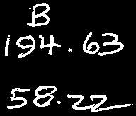
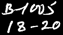
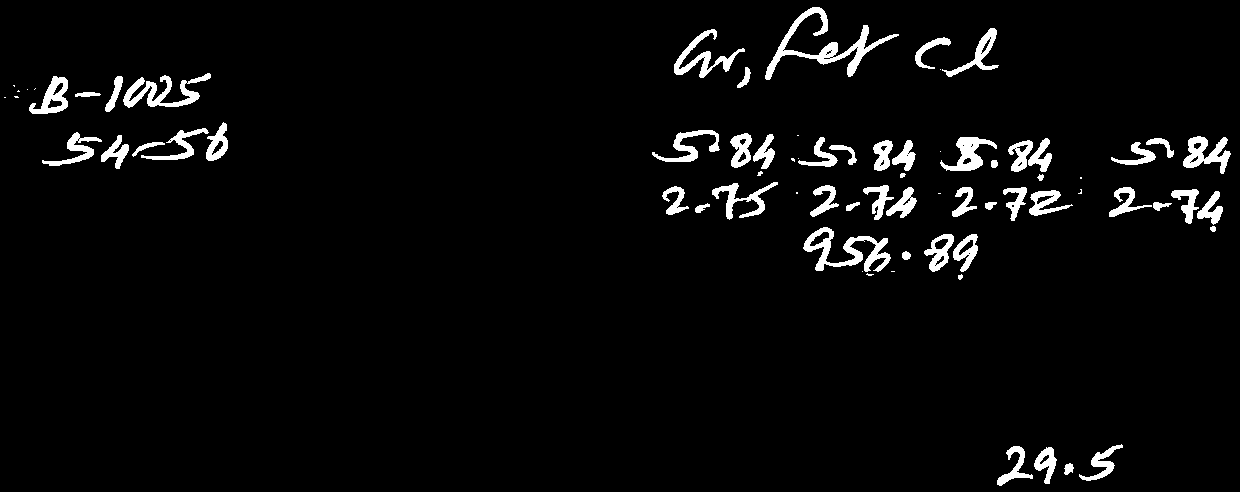
13-B1005
54-56
1.7
105
30
75
CH*
53
69
1.06
53
69
CH**
56-58
2.0
54
69
58-60
2.25
36
60-62
1.4
77
25
52
CH*
36
85
0.86
36
85
CH**
62-64
1.5
90
30
60
CH*
51
64-66
2.1
41
66-68
1.6
46
68-70
1.7
90 25 65
100100
98
0 2
98 CH
47 73
1.10 47 73
CH**
70-72
2.25
58
72-74
1.9
51
74-76
2.1
79 29 50 100100100100
97
0 3
97 CH
48
76-78
2.6
51
72
78-80
2.2
63
80-82
1.3
95 32 63 99 98 97 95
93
2 5
93 CH
71 57
1.44 71 57
CH**
82-84
1.9
35
84-86
1.3
77
23
54
CH*
39
84
1.08
39
84
CH**
86-88
2.2
24
88-90
18
10095 15
0 85
15 SM*
22
90-92
93-94.5
34
95-96.5
98-99.5
12
19
Notes:
- Classification based on laboratory test.
USCS Symbol*
- Classification based partially on laboratory test results together with visual description.
USCS Symbol**
- Classification based only on visual descriptions.
USCS Symbol
5
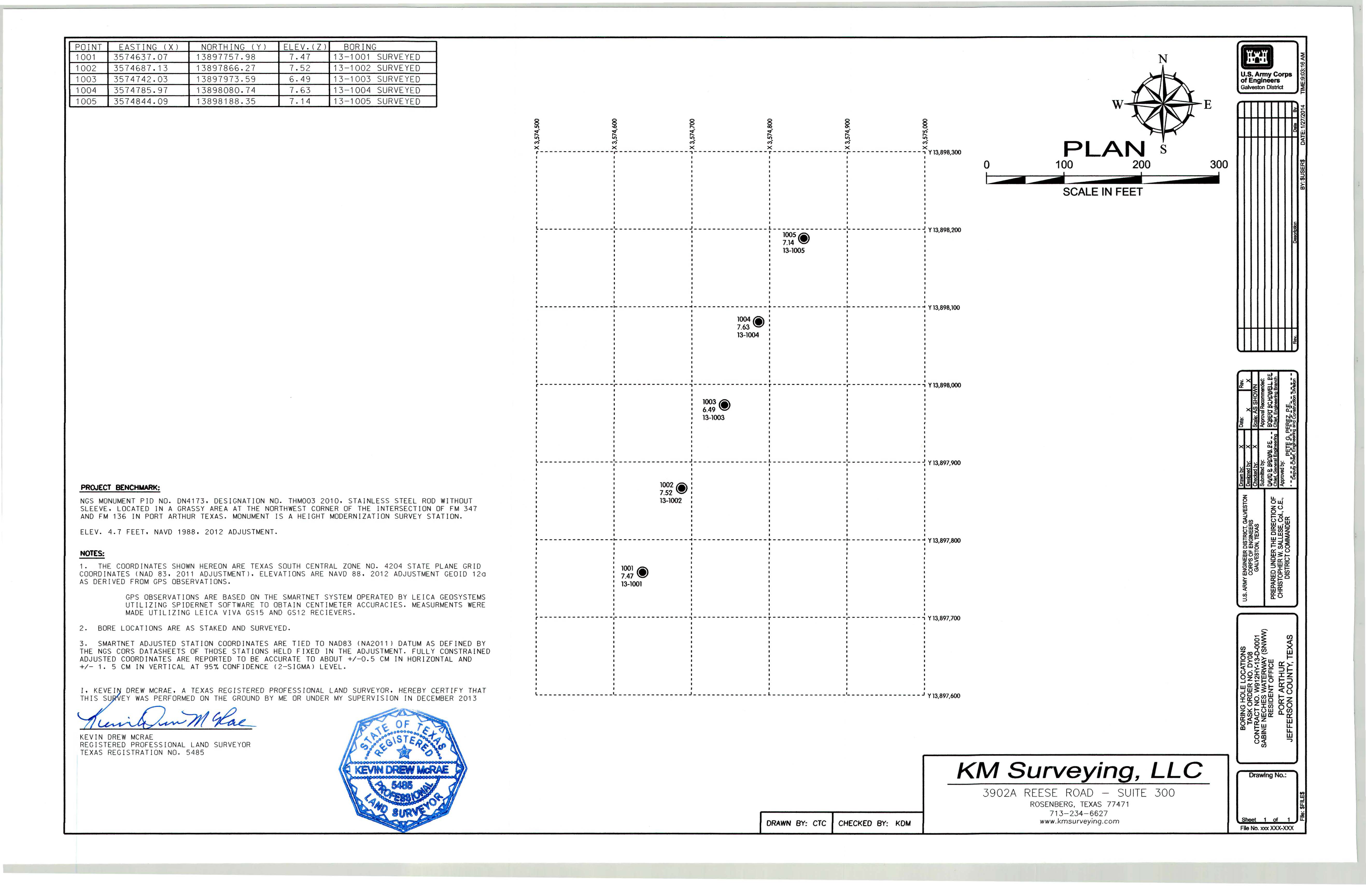
POINT
EASTING
(X)
NORTH ING
(
Y)
ELEV.(Z)
BORING
100
1
3
574637
.
0
7
138977
57
.
98
7.47
13-
1
001 SURVEYED
100
2
357
4
687
.
1
3
1
3897866
.
27
7.5
2
13
-
1
002 S
URVEYED
1003
35
7474
2
.
03
13897973.59
6.49
13-1003
S
URVE
Y
ED
1004
35
7478
5
.
9
7
13898080.74
7
.
63
13
-
1004
S
URVEYED
1005
3
574844.09
13898188
.
35
7
.
14
1
3-
1005
SU
RVE
YED
PROJECT BENCHMARK:
N
GS
MONUMENT PJO NO.
ON41
7
3,
OESIGNATJON
NO.
THM
003
20
10
,
S
TAJNLE
SS
STEEL ROD
WJ
THO
U
T
SLEEV
E,
LOCATED
IN
A GRASSY
AREA
AT
THE
N
OR
THWE
ST
CORNER
OF
THE
IN
TER
SEC
T
IO
N
OF
FM
3
47
AND
F
M
136
JN PORT ARTHUR TEXA
S
.
M
O
NUMENT
I
S
A HEIGHT MODERNIZATION SURVEY
S
TATJON
.
ELEV
.
4
.
7
FEET
,
NA
VO
1988
,
201
2
ADJUSTMENT.
NOTES:
1
.
THE
COORDINA
TE
S SHO
WN
HEREON
ARE
TEXAS
SOUTH
CENTRAL
ZO
NE
N
O
.
4204
S
TATE
PLANE
G
RID
COORDINA
TE
S (NAO 83,
2
011
AD
JUST
MENT
)
.
E
LE
VATIO
N
S
ARE NA
VO
88
.
20
1
2
ADJU
STM
ENT
G
EOJD
1
2
0
AS
DERIVED
FROM
GPS
OBSERVATIONS
.
GPS
OBSERVA
TJON
S
ARE
BA
S
ED
ON
THE
S
MARTNET
SYS
TEM
O
PER
A
TE
D
BY
LE
I
CA
G
EOS
YS
TEM
S
UTILIZIN
G S
PIOERNET
S
OFTWARE
TO
OB
TAIN C
ENTIMETER
ACCURAC
IE
S.
MEA
S
URMEN
T
S
WER
E
MADE
UTIL
I
Z
IN
G LE[CA
V[VA
GS
1
5
AND
GS12
RECI
EV
ERS
.
2
.
BOR
E
L
OCATI
ON
S
ARE
AS
STAKED
AND
S
UR
VEYED.
3.
SMARTNET ADJUSTED STAT
[
ON COORD
IN
AT
E
S
AR
E T
IED
TO
NAD83
(NA2011)
D
ATUM AS
DEFINED BY
THE
N
GS
CORS
DATA
S
HEET
S OF
THO
S
E
ST
ATIONS
HELD
FIXED
IN
THE
ADJU
S
TMENT
.
FULL
Y CO
N
S
TRAINED
ADJU
S
TE
D
COORDINATES
ARE
REPORTED
TO
BE
ACCURATE
TO
ABOUT +/
-0
.
5
C
M lN HORIZONTAL
AND
+
/-
1
.
5
C
M IN
V
ERT[
CA
L
AT 95%
CO
NFIDEN
CE (2-S
I
GMA
l
L
EVE
L
,
DREW
M
CRA
E
,
A
TEXA
S
REGISTERED
PR
O
FE
SSIO
NAL
LAND
SURV
E
YOR
,
HER
EBY CER
TIFY
TH
AT
E
Y
WA
S PERFORME
D
ON
THE
GROU
ND
BY
ME
OR
UNDER
MY
S
UPE
RV
J
S[O
N
[N
DE
C
EMBER
20
1
3
~~/If~
{J o~
-
,
:\~
..........
~k
KEV[N DREW
M
CRAE
~"t'- ..
\ST
E
~"L
REG
[
S
TEREO
PROFE
SS
ION
AL
LAND
SURVEYOR
c:o
0
,;,-:.._<t_,~
~
,9~_...'1(1)•
TEXAS
REGISTRA
T[
ON
NO
.
5485
£4.,,.-
JI!(°
~°\
t
KEVIN
DREW
McRAE
,1
,
\.~5485
.....
,w
~~
~
g
!
!
I
M
M
M
M
M
x
x
x
x
x
x
r
-
-
-
-
-
- - -
-
- -
- -
- - -
- -
-
-- - - - - - -- - -
-
,
-
-
-
-
-
- - - -
-
-
-
- -
- -
r
-
-
- - -
-
-
- - -
-
- -
-
-
-
.-
-
- -
-
-- - - -- - - - -
-
,
Y 1
3,
898
,300
~
-
_ - - _ - -
_
-
- - - - -
-
-
- - - - -
-
- - - - - - - - -
- - - -
-
- - - - -
-
-
-
- - -l
- - -
-
-
-
-
-
-
-
-
-
- -
- -
-
-
-
-
- - -
- - -
-
-
-
-
-
~
Y
13
,
898
,
200
I
:
:
1
005'i'
I
:
:
:
7
.
14~
:
:
:
:
13-1005
:
I
I
f
I
I
I
I
I
I
I
I
I
I
I
I
I
I
I
I
I
I
I
I
I
I
I
I
I
I
I
I
I
I
I
I