c
PROJECT
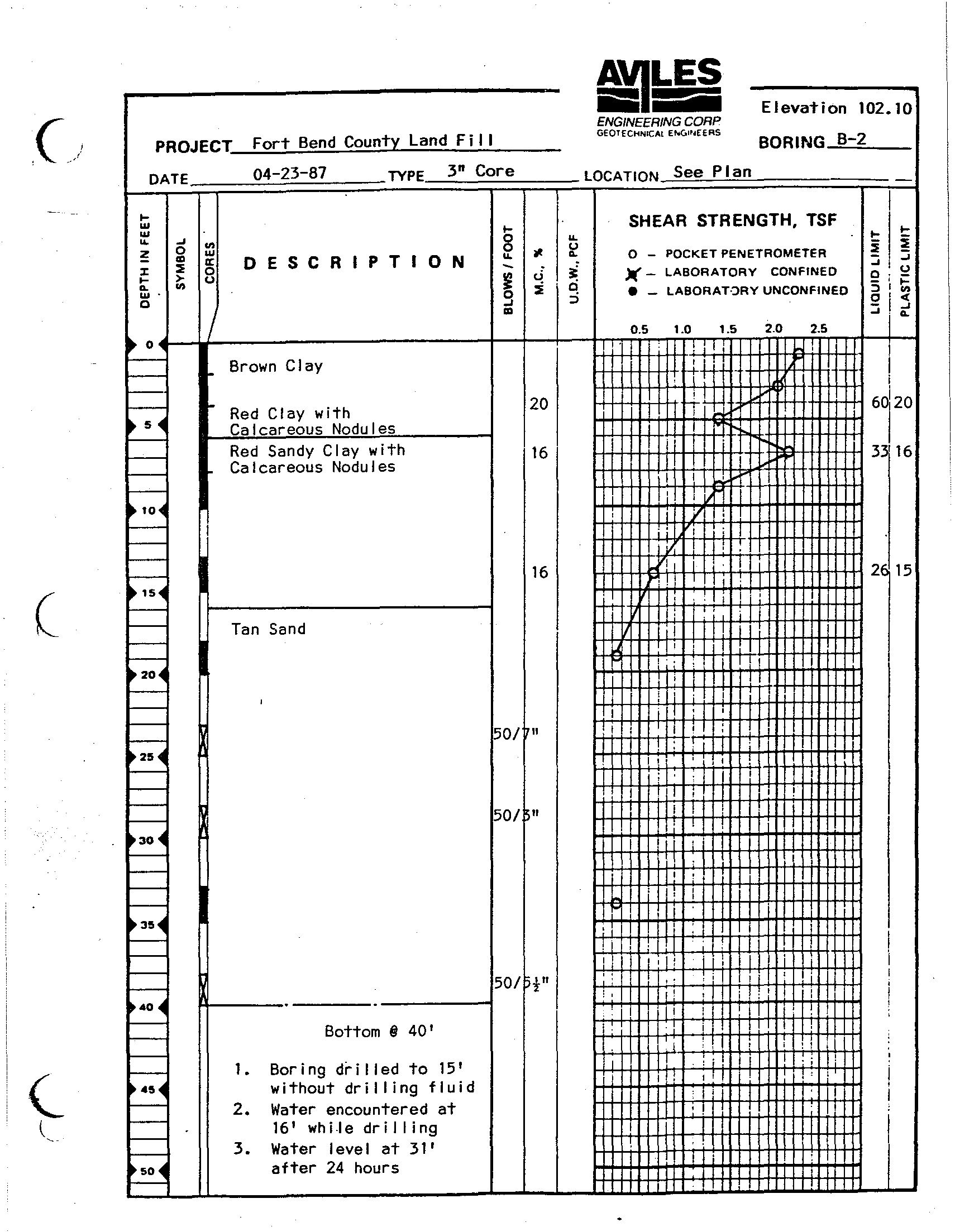
ForT Bend CounTY Land F i
I I
DATE
04-23-87
TYPE
3" Core
I-
...
w
~
....
:t
W.
o
~
..
o
w
~
15
DESCRIPTION
~
u
I-
-
8
...
ElevaTion 102.10
ENGINEERING CORP
GEOTECHNICAt Et.o(,IP4EERS
BOR ING -,B=---=2:.....-_
LOCATION See P I an
SHEAR STRENGTH, TSF
o -
POCKET PENETROMETER
~
_ LABORATORY CONF'NED
• _ LABORAT.:>RY UNCONF'NED
I- I-
~
!
~
o.u
51~
c'<c
::; I'
i
~_~J_--------------------------~--~-+---trnnO,.5~~1.rOrrrln·5~.T2·TOrrri2~.5Trrrl~+-~
~
0..
' I
'I
-
_ Brown Clay
f+j++++I-H
I
'i '
I
-
i
i
~
Red Clay with
20
~I+++I-++1++:-H~I++-++t+1-+++Hi+I
60
1'
20
~
Calcareous Nodules
,----
i
i
f---
Red Sandy Clay wiTh
16
1+II+++I-+.J-l+++I-+J-,H+taHtt-f++-H 33'16
f---
Calcareous Nodules
1
1
f---
~ 10~
f---
>----
'----
,----
~ lS~
~
-
-
~20~
-
-
~2'~
I--
t----
t----
I--
~30~
I--
t----
I--
t----
~3'~
t----
f---
f---
f---
~40 ~
f---
t----
-
-
4'~
-
Tan Sand
A------.------.-------~
BOTtom II 40'
1. Boring drilled to 15'
wiThouT dril ling fluid
2.
WaTer encounTered aT
16' whiJe dril ling
3. Water level aT 31'
after 24 hours
16
50/ "
50/~"
50/ pi"
I
I
I
,Ff
I ,
' . 1 i
"
H-1++KlI,-t-,+-,
H.JHI~i+-i-HTH+t+1*H-t-H
2, 15
I,
!
I' j
i: I.'
i I II
-I' ,I
! '. ;,
!
liT
!
i
I
I ii'
I : T I' :
I
:
I I
, I
1
;
I
I
I
iT,
I
,!