Under the drawing toolbar
select "Draw", then "Snap", then "To Grid"
Paste the pictrues into A1, G1, A17, and G17
Resize the height to 3"
For the next page, paste the picture in the next cell
down from the bottom of the bottom two pictures.
There are six pages formatted this way.
NAD
1983
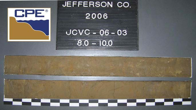
DRILLING LOG
MLLW
UNDISTURBED (UD)
FLORIDA DEP ROSS JEFFERSON_VIBRACORES_2006_1-8.GPJ FL DEP ROSS.GDT 12/14/06
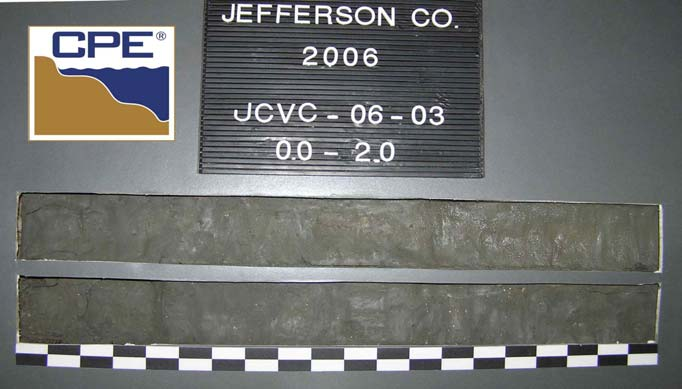
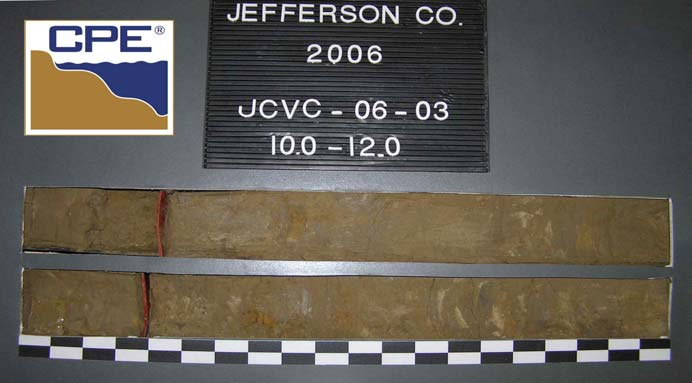
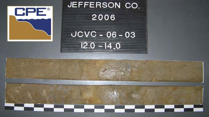
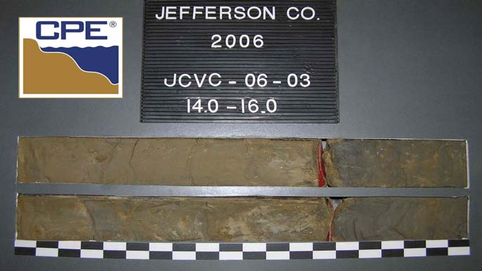
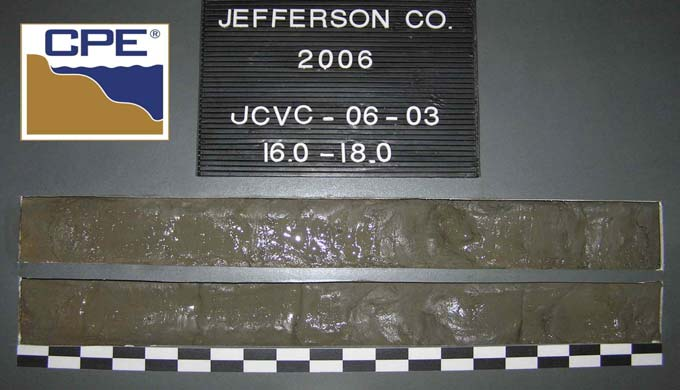
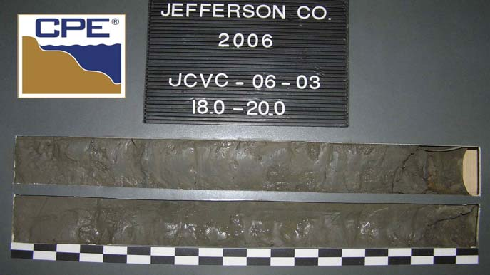
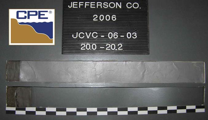
JCVC-06-03
CLAY,
stiff
to
soft,
dark
gray
(5Y-4/1),
(CL).
0.0 Ft.
VERTICAL
INCLINED
15. DATE BORING
18. SIGNATURE AND TITLE OF INSPECTOR
LOCATION COORDINATES
DISTURBED
11. MANUFACTURER'S DESIGNATION OF DRILL
10. COORDINATE SYSTEM/DATUM
ML
20.1
Ft.
Texas
South
Central
14. ELEVATION GROUND WATER
19.1
-57.1
-55.4
-41.0
20.1
17.4
3.0
End
of
Boring
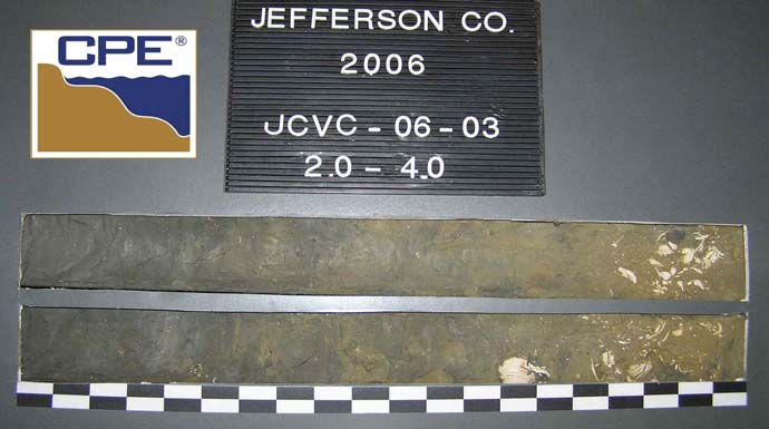
Expansion
Material,
(CL).
CLAY,
stiff,
dark
gray
(5Y-4/1),
(CL).
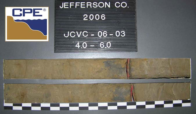
CLAY,
trace
shell,
very
stiff;
(1.5"x
1.5")
shell
fragments
@
3.3';
4.0"
shell
layer
@
3.6',
light
olive
brown
(2.5Y-5/4),
(CL).
Texas
Geotechnical
Sand
Search
Jefferson
County
Texas
17. TOTAL RECOVERY FOR BORING
16. ELEVATION TOP OF BORING
INSTALLATION
DIVISION
-58.1
10-09-06
12:47
-38.0
-38.0
Ft.
3.0 In.
STARTED
Alpine
Ocean
Seismic
Survey,
Inc.
SHEET 1
JCVC-06-03
DEPTH
(ft)
ELEV.
(ft)
CLASSIFICATION OF MATERIALS
Depths and elevations based on measured values
JUN
04
MODIFIED
FOR
THE
FLORIDA
DEP
JUN
02
SAJ
FORM
1836
19.1
Ft.
7. DEPTH DRILLED INTO ROCK