I
I
I.
o
~
en
~
~
0..
o
W
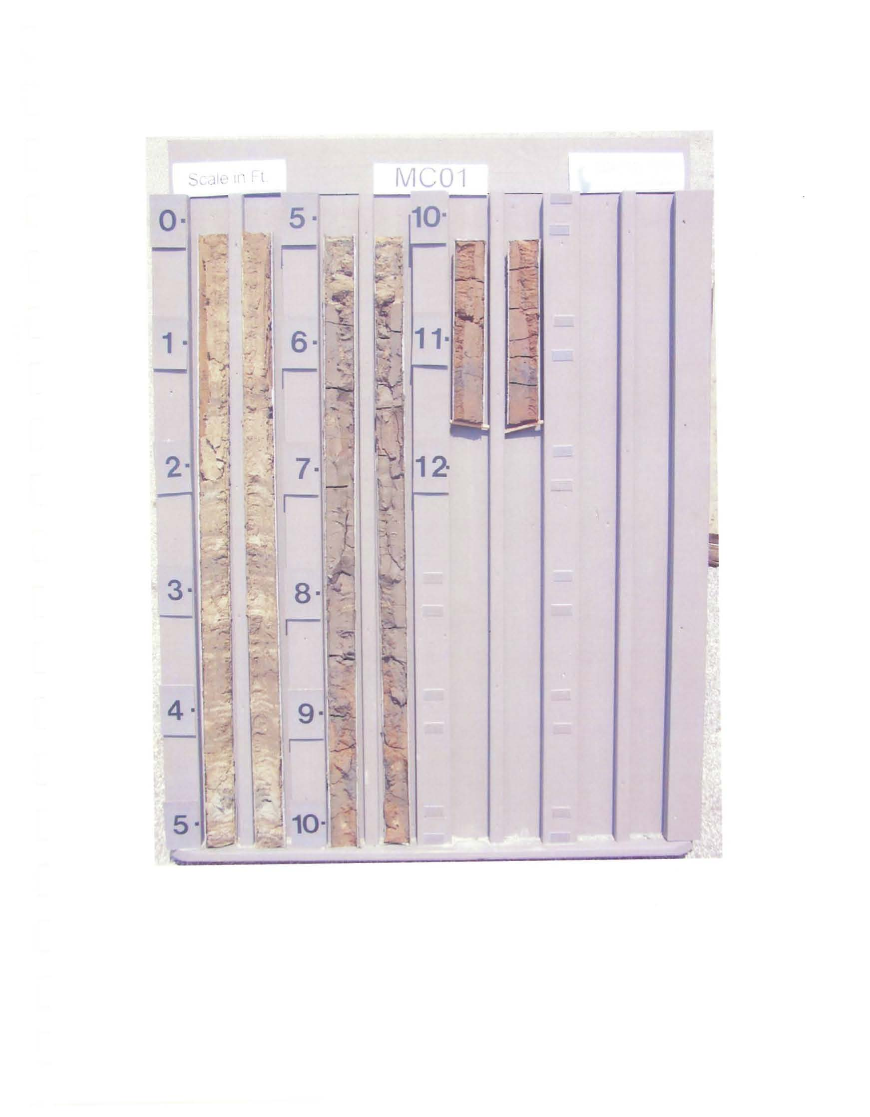
DRILLING LOG
DIVISION
PROJECT
Matagorda County Sand Search
Matagorda County, Texas
2. BORING DESIGNATION
MC01
3.
DEG.FROM
,
:
VERTICAL
6. THICKNESS OF OVERBURDEN
0.0 Ft.
7. DEPTH DRILLED INTO ROCK
N/A
8. TOTAL DEPTH OF BORING
12.2 Ft.
,
,
, BEARING
ELEV.
DEPTH
CLASSIFICATION OF MATERIALS
MC01
18. SIGNATURE AND TITLE OF INSPECTOR
(ft)
(ft)
Depths and elevations based on measured values
REMARKS
,COMPLETED
: 05-12-OS
----------------------------~--~~--------------------------------~O
Interbedded, fine grained, quartz, SAND and
CLAY, clay content increases to base, abrupt
contact, Sand is
yellow
(10YR-7/6),
clay is
dk. grayish brown
(10YR-4/2),
(SC).
Organic-rich,
CLAY, gradational contact,
dark gray
(10YR-4/1),
(OH).
Plastic, CLAY,
sandy (qtz) below 9.S', redish
brown
(2.SYR-4/4),
(CL).
End
of Boring
SAJ FORM 1836 MODIFIED FOR THE FLORIDA DEP
JUN 02
JUN 04
S
10
S
20
" It .
I